A flashback to my youth brings back memories of intrepid travel pulling at my compass. I had just finished a year backpacking through Europe and was hungry for new terrain. An offer to work in Costa Rica arrived at exactly the right moment. I accepted a role as assistant to a start-up banking venture, bought a one-way ticket to San José, and set off to live la pura vida.
In the early 1990s, Costa Rica still felt very much like the developing world. Though politically and economically more stable than many of its Central American neighbours, life outside compact San José was rural and agricultural. Tourism existed, but only just — a trickle of backpackers squeezing in one last adventure before careers or graduate school.
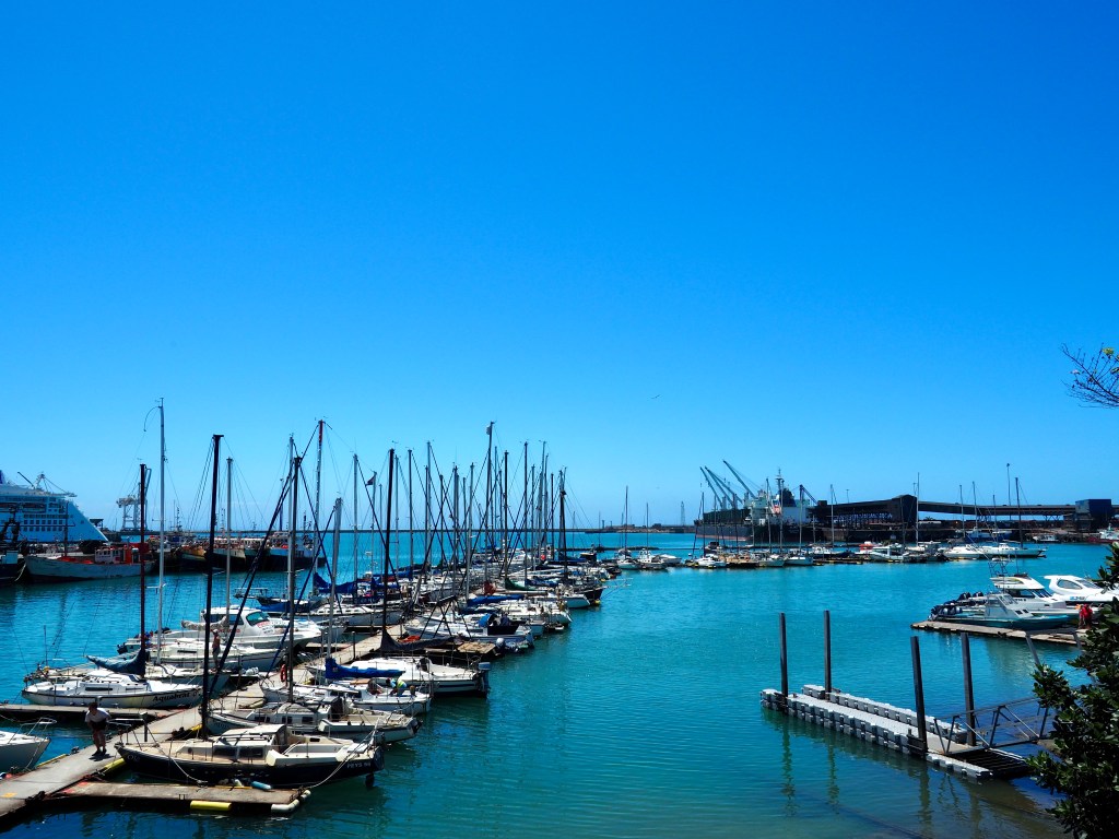
The roads out of the capital were unpaved and cratered. Bus drivers barreled through potholes with heroic indifference while old American pop music crackled through blown speakers, barely masking the squawk of chickens bundled in baskets and hoisted onto the roof alongside passengers. I grew fond of those rickety, retired American school buses, partly because I spent far more time exploring the country by bus than working in the city.
The banking venture that had lured me there never quite launched. Delays piled upon delays. Eventually I tired of waiting for a job that failed to materialize — and of lingering around my boss and his hard-worn drinking companions. With backpack and savings intact, I set off through Central America instead. It proved a wise decision. “George,” as it turned out, was a professional con artist who eventually fled the country with a bank full of ill-begotten funds and a stolen car, leaving behind little more than broken hearts and a handful of illegitimate children.
Return to a Revised Costa Rica
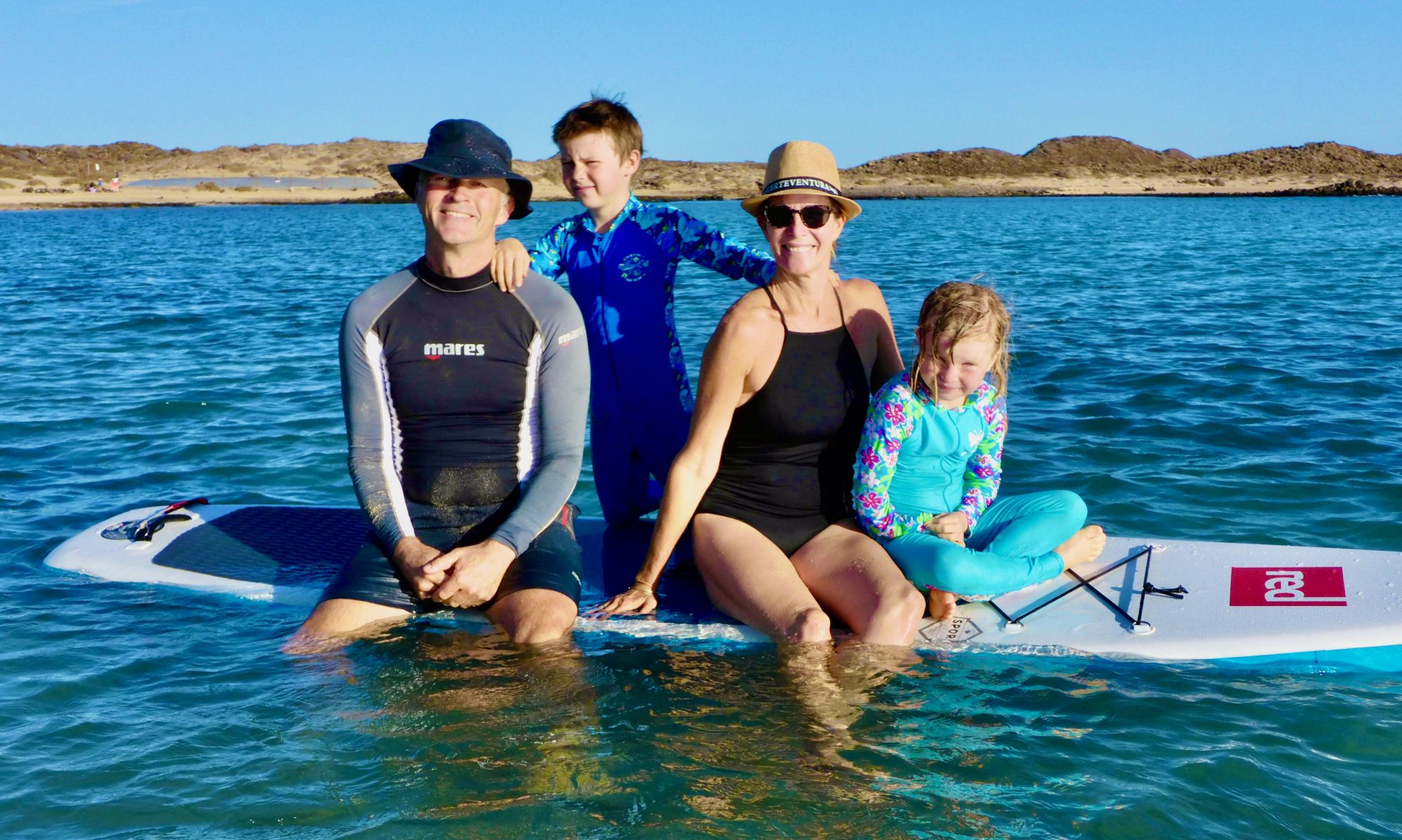
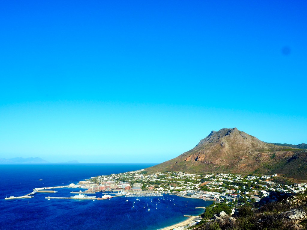
Fast forward twenty-five years. Returning to Costa Rica had not been part of our Pacific plans. My husband and I were focused on the Polynesian islands that lay ahead. Having both spent years sailing — together aboard Ātea and separately before we met — we were drawn to the vastness of the Pacific. Central America promised something different. We agreed that a few months in Costa Rica would offer contrast and diversity. With minimal planning, we sailed north to Golfito, our port of entry on the country’s southern Pacific coast. I should have remembered the bureaucracy.
Costa Rica greeted us with excessive officialdom delivered beneath a friendly smile. Customs and immigration required an agent — mandatory and non-negotiable — and the agent’s fee effectively doubled the cost of entry. The $400 processing bill caught us off guard. After several attempts to sidestep the system, a sympathetic agent reduced the fee by half, a compromise we gratefully accepted.
With paperwork underway, we cleared customs and immigration efficiently — only to be stalled by biosecurity. A visual inspection of the boat was required. As Costa Rica had been an unplanned detour, we had provisioned heavily in Panama for the Pacific crossing. Our freezer was packed with a year’s worth of meat. The biosecurity officer, with the focus of a trained sniffer dog, uncovered every packet of pork we had meticulously stowed in Panama. Bacon, cutlets, mince — each destined for incineration. As the officer began pulling out $1000 worth of meat, my composure wavered. In rusty Spanish, I negotiated. When negotiation failed, I pleaded. Eventually, compromise prevailed: the meat was returned to the freezer, chained, locked, and sealed with official biosecurity tape. I accepted a short stint of vegetarianism in Costa Rican waters, but my inner carnivore — and our Pacific provisions — were saved.
La Pura Vida: An Eco-Adventure Playground
Once cleared in, we finally had space to absorb the country itself. A glance through glossy brochures confirmed what was immediately apparent: this was not the Costa Rica I remembered. The backpacker haunt of the 1990s had transformed into a polished eco-paradise catering to adventure seekers and wellness devotees alike. White-water rafting. Zip-lining. Suspension bridges. Canyoning. Surf breaks. Active volcanoes. Bubbling hot springs. The list of eco-adventures seemed endless.
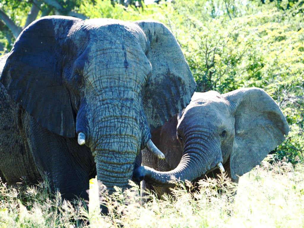
Costa Rica has become one of Central America’s most celebrated destinations — and with reason. Roughly the size of West Virginia, the country contains extraordinary ecological diversity: highland cloud forests in the north, lowland rainforests in the south, black sand beaches on the Pacific coast, white sand on the Caribbean coast. More than a quarter of its territory is protected national park or reserve, with secondary forest reclaiming former farmland. Wildlife sightings aren’t a matter of luck — they’re guaranteed.
Cruising north along the Pacific coast allowed us to ease in gently. Golfo Dulce, the tropical fjord in the southern province of Puntarenas, was spectacular. Phosphorescence shimmered brilliantly at night. Dolphins tracked our wake. Scarlet macaws flew in bonded pairs overhead, their raucous calls replacing seabird cries. Howler monkeys provided a guttural soundtrack from the jungle canopy.
Traveling by yacht gave us freedom — quiet anchorages, long wildlife walks, waterfalls discovered without ticket booths. The children quickly adapted to long days outdoors, and we were reminded that some of Costa Rica’s best offerings require nothing more than curiosity and time.
Further north, however, subtle transition became full immersion. From Drake Bay to Tamarindo, tourism intensified — and we surrendered to it. We rappelled into canyons, zipped through leafy canopies, rafted rapids, soaked in hot springs, and trekked volcanic slopes. Guided along forest trails, we searched for sloths, monkeys, coatimundis, tapirs, and the elusive quetzal. Everything was available — at a premium.
La Tourista Vida: A New Reality
People had warned us about the cost. They were right. Activities routinely ran into the hundreds of dollars. Add accommodation and a guide, and costs quickly climbed into the thousands. Eco-lodges and curated experiences dominated the landscape. Convenience came carefully packaged — and priced. Crowds followed closely behind.
Paying to hike to a waterfall is one thing. Sharing it with a hundred camera lenses and sunburnt bodies is another. Charging through “must-see” attractions began to feel transactional rather than transformative. I found myself wondering what had become of the peaceful, understated pura vida I once knew. Had it been replaced by pura tourista?
Having spent much of my time traveling on a tight cruising budget, it was daunting to confront a country where nearly every outdoor experience carried an inflated price tag. Still, we were there. So we leaned in — selectively. We splurged on some excursions and passed on others. We skipped the shuttles, choosing hitchhiking or hiking instead. We walked where others rode quads.
When we weren’t chasing adrenaline, we surrendered to softer pleasures: long surf sessions, melting ice creams, refreshing piña coladas, aimless wanderings through trinket shops, indulgent late mornings, and the occasional hangover. We had come for a change of pace. Costa Rica delivered one — just not the one I remembered.
La Pena Vida: Cruising Realities
As a cruising destination, however, Costa Rica is complicated. The volcanic coastline is dramatic, but the water often runs muddy and the swell is relentless. Anchorages are limited. Surf landings are demanding. Prevailing winds are inconsistent, leaving long stretches of calm seas better suited to powerboats than sailing yachts.
Marinas cater primarily to the lucrative sport-fishing industry. Visiting cruising boats occupy less-profitable space and are sometimes treated accordingly. Dinghy docks are scarce and beach landings require negotiation — with surf, with security, and often with skeptical onlookers. More than once, we left our dinghy behind and swam ashore with our clothes in dry bags, having no other way to make a shore landing.
And yet, access remained to our advantage. We reached remote communities, quiet beaches, and working fishing villages untouched by curated tourism. We watched fishermen launch heavy skiffs through pounding surf, timing waves with precision. Eventually we learned to read the sets ourselves — waiting for the final roller before gunning toward shore in its wake. There was camaraderie in that shared challenge. In those saltwort fishermen, I glimpsed the enduring truth beneath the pura vida branding.
La Pura Vida, Reconsidered:
When we first arrived, I was startled by how thoroughly Costa Rica had transformed — from scrappy backpacker enclave to polished eco-powerhouse. Combined with challenging cruising conditions, it initially felt like a mismatch.
But over time, I realized that cruising Costa Rica is not about sailing — it is about access. The ability to toggle between spectacle and solitude. Between curated adventure and quiet coastline. Costa Rica today is waterfalls and zip-lines, camera clicks and tour buses. It is also silent anchorages, scarlet macaws at dawn, and howler monkeys echoing through jungle valleys. It is sloths and surf, fishermen and phosphorescence, crowded beaches and empty shores. And somewhere between the brand and the bustle, la pura vida still exists — less a marketing slogan than a way of being. You simply have to know where to look.
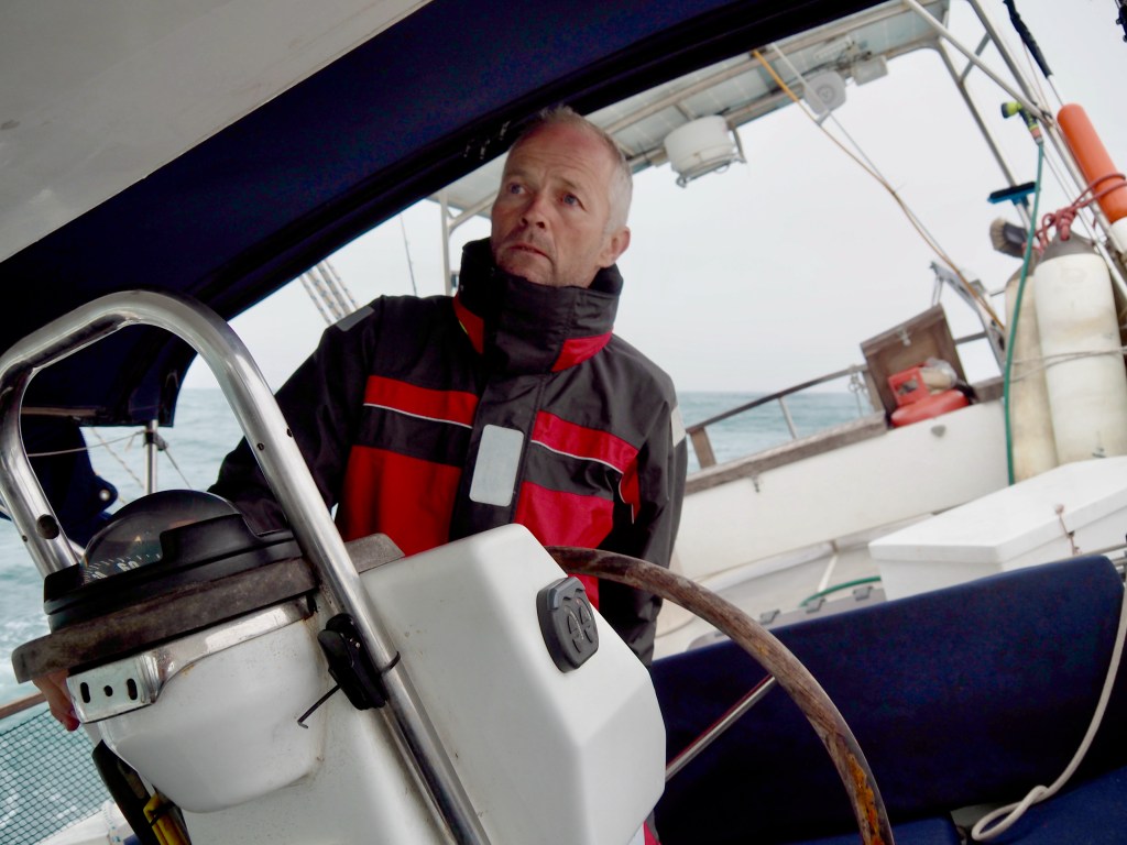
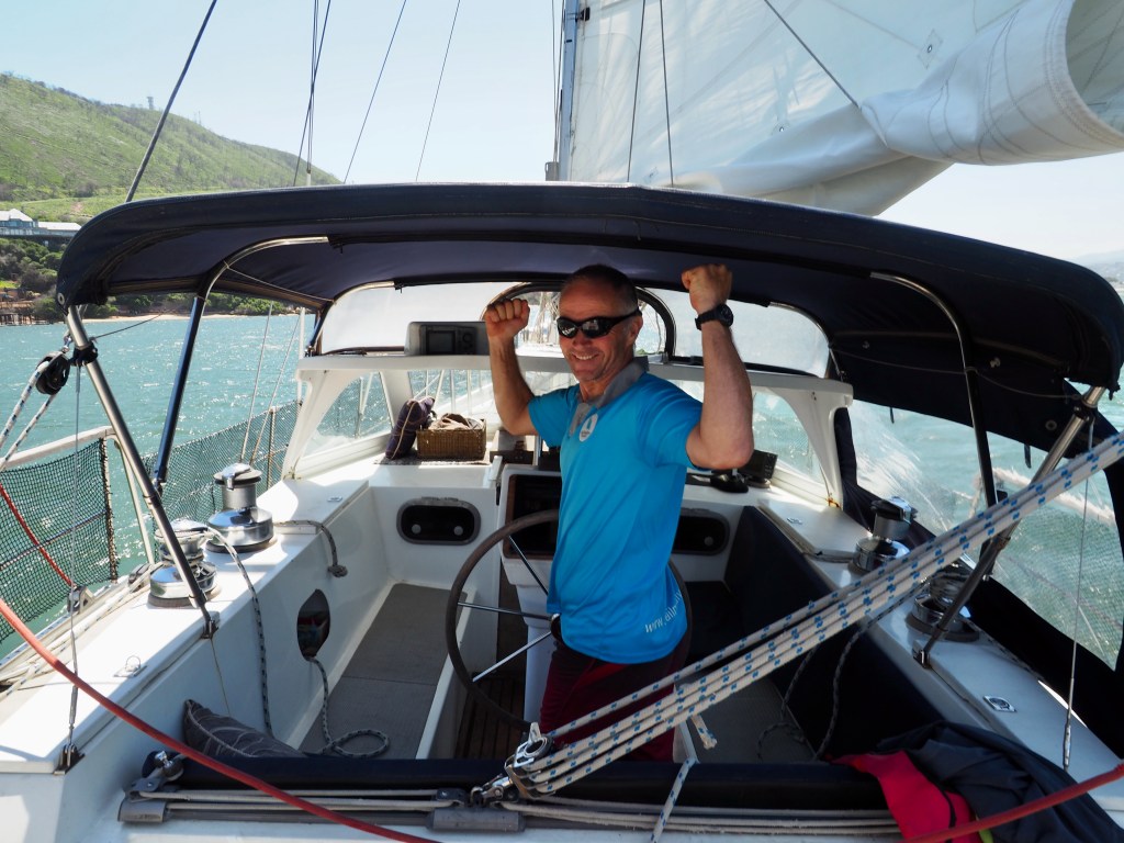
As we cleared through the Panama Canal andS.V. Ātea, our 45’ steel cutter rigged sloop, sailed back into Pacific waters for the first time in eight years, I looked west with a sense of despondency. Whereas all our cruising associates had worked hard to get to this stage and looked upon the Pacific as a the beginning of an epic adventure, I looked to it as the conclusion of ours. The Pacific in 2011 had been our beginning, but the Pacific in 2022 was our end: Twenty twenty-two would be the last year of an eleven-year circumnavigation and I was reluctant to take a step towards the conclusion of this lifestyle.
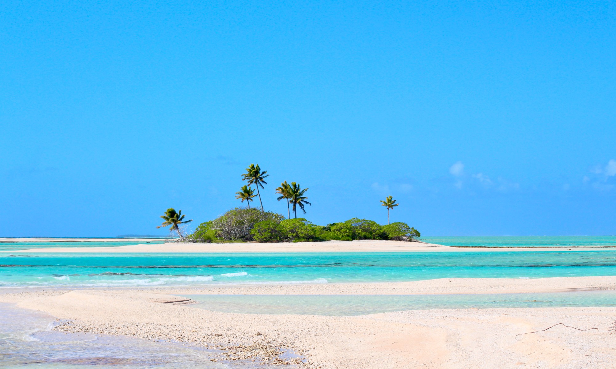
Yet, the best of the best lay before us. The Tuamotus are a string of 78 atolls that lay across the central Pacific, one of five distinct regions that make up French Polynesia. With the Marquesas and Gambier Islands to the east and the Society and Astral Islands to the west, this central group is a string of relaxed, quiet low-lying atolls.
We sailed from the Gambier Islands to our first atoll, Amanu, in early June. Having sailed 500 miles through a continuous sea, it was remarkable to see trees set upon the ocean a mere 5 miles ahead of us. A mid-ocean mirage. Yet there it was, a round ring of coral breaking the surface to provide us protection from the roll of a continuous low swell. As an outer-lying atoll on the southwestern edge of the group, Amanu was a quiet, sparsely populated nook on the edge of an endless sea. In addition to the crab and coconut trees, the fish and manta, a small group of Polynesians lived on this remote mid-ocean outpost. A small village occupied one corner of the atoll, sleepy and slow-paced. We wandered the tidy streets to pass orderly rows of houses, tricycles parked outside property fences and gravestones set inside. We passed a person or two, otherwise the little township held the air of abandonment. The solitude suited us perfectly.
We moved around the inner rim of the atoll, enjoying the peaceful beauty around us. Long rolling waves that’d transited hundred of miles crashed onto the outer reef, washing over to settle like still pond water in the inner lagoon. The tops of palm trees waved gently in the breeze, offering perches for the terns, boobies and frigate birds taking rest and refuge. We walked the shores collecting seashells and made driftwood rafts for our 8-year old pirate and 10-year old brigadier, stick weapons sheathed as they battled for imagined bullion and lost treasure. We snorkelled and enjoyed the colourful bommies surrounded by a healthy population of reef fish and paddle-boarded the drop-off with oceanic manta drifting by below. We built bonfires on the beach out of coconut fronds, pulled down as we dislodged coconuts from their nest above our heads. We enjoyed a slow gin to the slip of the setting sun and gazed up at the fantastic spray of fairy lights sparkling in the complete black that surrounded us as night set in. We were “stranded on a deserted island” with all the conveniences of a well-stocked supply boat, Ātea our all-inclusive Club Med.
Our next few atolls held the same feeling of remote isolation, punctuated by easy company within the small villages tucked into a corner of the lagoon. Amanu, Makemo and Tahanea were all similar in geography as these atolls were further from the more populated Societies. The townships were smaller and the feeling more remote, yet each atoll maintained a distinct uniqueness: Amanu had the feeling of total remoteness, Makemo of aquatic purity, Tahanea of unspoiled beauty.
Tahanea was our golden gem. It is an uninhabited nature reserve, therefore the only resident is feathered, shelled or scaled. The lack of hunting and poaching results in an abundance of wildlife life unfazed by the odd human guest. A few of the uninhabited islets within the lagoon provide hatcheries for three species of booby birds: The red-footed, the brown and the masked booby. To walk through the island to the abrasive warning squawk of a protective parent and the curious eye of a newborn chick is a joy, and the frenzied swarm of the disturbed flock swooping and diving overhead a curious intimidation. Step from the sand to the shallows and you enter another nursery, as foot-long predators swim and skirt around your submerged ankle, the tip of their fin barely breaking the surface. Our timing for Tahanea was very specific: We were there to witness the grouper spawning, and it was this event that we based all our planning around. During the week preceding the full moon in July, the marbled grouper perform their mating ritual: A spiralling whirlpool of fish, rippling currents of metallic colour settling their moulted brown colour alight. This year, however, it wasn’t in July. Nature likes to toss out the unexpected, and despite our well-planned timing the spawning occurred in June this year, a month earlier than predicted. We missed the grouper spawning but, by grace, got to watch red snapper spawn instead in an equally impressive courtship dance. The grouper were still around and in larger-than-normal numbers, but all resting meek and docile on the ocean floor. We came upon a large school of red snapper just inside the pass and followed them for awhile, unaware of the performance that was about to come. Slowly the numbers grew and their swimming pattern became more erratic; rather than one mass, they started grouping and regrouping, circling each other, one chasing another out of the pack. As the school grew and compressed into a tight ball, a female would break out of the group in an ascending dash and a string of suitors would chase tail in a long spiral behind her, a pearlescent flash of colour ripping down their sides in a trance-inducing display. At one point a lemon shark swam through the group, and bold of purpose, the entire school turned on it and chased the aggressive shark away. To hear it I wouldn’t believe it, but that day I watched the many defeat the mighty.
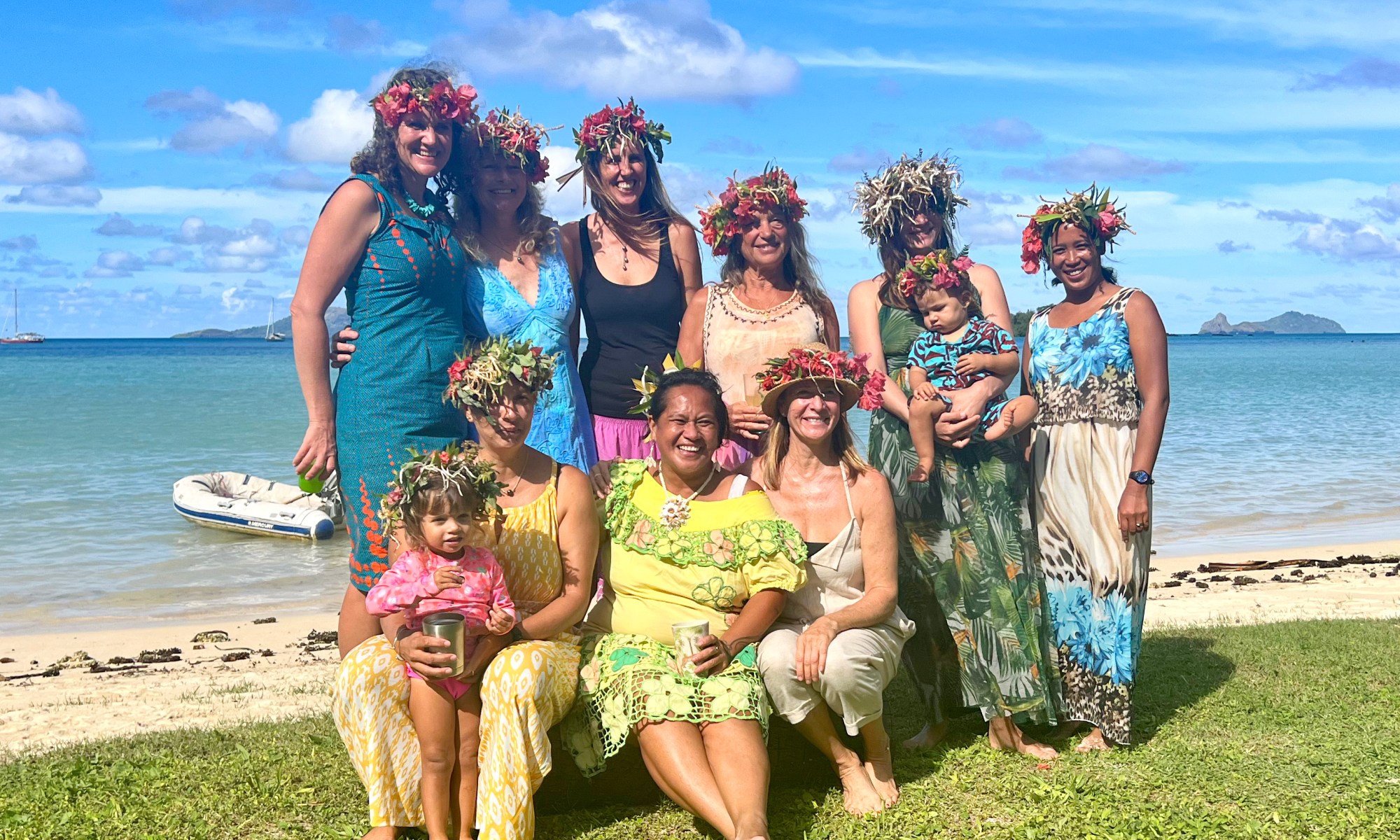
From a brilliant choreographed display of nature, we next sailed for Fakarava to watch the cultural competitions and performances of the Heiva, French Polynesia’s version of the Olympic Games. The Heiva is a month-long festival that honours Polynesian history through song, dance and traditional competitions that occurs every year in July, dating back to 1881 and is the oldest festival in the Pacific region. Fakarava, being the most populated atoll in the Tuamotus, would hold the best example of the Heiva in a more local tradition than the highly popular but overly commercialised displays in Tahiti. And it was so: We joined the week long festivities as both enthusiastic observer and reluctant competitor. We were dragged into participating in the fruit-carrying race, the javelin toss, the coconut husking competition — perhaps we were a bonus in their own entertainment, as we were no equal in any event but was bonding to share in the Heiva and displayed a cultural openness, generosity and hospitality. Fortunately we were not invited to join the Ote`a, a powerful and seductive Polynesian dance that only humiliate any attempt by non-native guests, a shame they spared us. The week was fantastic. While we may not have witnessed the grand staged performances of Tahiti, we participated in a community festival that was inclusive, spirited, and fun, and even walked off with a few cash prizes — a token of support for our participation rather than our achievement.
Fakarava is also home to “the Wall of Shark.” I thought the name a dramatisation, but the description is purely literal: Hundreds of shark, predominately greys, pacing the southern pass in mass. I’ve never in my life seen so many shark in one place, and the thrill of getting in the water with them was a lifetime experience and one I will cherish above most others. With a fearsome reputation for aggression, it was amazing to be side-by-side with so many of them, idle and relaxed. We had local knowledge from cruising friends who’d spent considerable time in French Polynesia so we were able to dive freely amongst the shark, surrounding us in ludicrous numbers. The shark were our total focus during our stay in the South Pass of Fakarava, and we spent as much time as we could diving, snorkelling and swimming amongst them. If I could go back anywhere in the Tuamotus, it would be to return here, to the Wall of Shark, to swim side by side these docile predators.
Leaving Tahanea and Fakarava was like pulling teeth; none of us wanted to depart these rich and rewarding central atolls. But mid-season and the Societies lay ahead of us and it was time to weigh anchor and sail west. We enjoyed two short stops at Toau and Apataki and received a very warm welcome at both of them. In Toau we were welcomed by a local family who readily prepared lobster feasts for drop-in visitors, and we found two young bachelors in Apataki who’d laid their stake on a small island for a simpler life than had been on offer in the more westernised and fast-paced Tahiti. Unique to this island was a stone, set just off their homestead, which laid claim to the hopes, dreams and protections of mariners that’d travelled centuries before us. So we dressed up in palm-leaved hats and did our own ceremony for our continued safety and protection at sea, then spent the next several days with our hosts sharing bonfires on the beach, fish from their daily catch, and lobster freely delivered to our boat. While Tahanea was our favourite atoll from a naturalistic perspective and Fakarava from a cultural one, Apataki was our favourite from a humanitarian one. To be so openly accepted, befriended and included with no gain in return is the ultimate human experience. This was our farewell to the Tuamotus.
French Polynesia is remarkable, and the Tuamotus is the pinnacle of its beauty. To be able to explore these atolls from your own vessel offers a freedom that most modes of travel aren’t able to offer. A yacht pulls you from the chaos and delivers you to the calm. It offers the freedom to explore as you choose, where you choose and when you choose. It allows you access to places less traveled, less exploited, less trampled and offers solitude, beauty and nature’s bounty.
To return to the Pacific after spending time in different oceans and all the experiences that came with it, to see the Pacific as a sailor’s Mecca is a telling statement. I thought of the Pacific as an ending, but having just passed through French Polynesia I look back on it as an opening. I am reminded of all the beauty of this great ocean holds: The atolls are unique and isolated, and nature is allowed to bloom, to flourish, and to prosper. The passes are laid with expansive stretches of multi-coloured carpet, filled with large schools of fish and a healthy population of shark, whale, ray, pelagic and reef dwellers. Humpback spray their steamy breath into the air, manta glide past with graceful wings spread wide and the occasional whale shark sidles in for a curious peak. Each a treasure of nature, each representatives of an ecosystem un-depleted yet beseeching us as guardians of this earth to take care, to protect. If there is any place that best sets this example, it is the richness and diversity of the Pacific Ocean.
The Gambier Islands are exactly what dreams of Pacific sailing are made of: Silvery-purple pearls generously tossed into a palm like the casual distribution of M&Ms. Its high mountain peaks poke through dense green forest offering stunning panoramic views of a reef-filled lagoon and white sandy cays that break through aquamarine water, nothing but hermit crabs and fallen coconuts crowding the shores. An outrigger pulls alongside to offer tuna fresh from the hunt. A half dozen reef shark circle around us like curious, eager puppies. The Gambier Islands fulfil every desire for an authentic Polynesian experience: A taste of the popular Societies, the lush Astrals, the crystalline Tuamotus and the spectacular Marquesas bundled together in one small island group.
Our decision to head for the Gambier Islands was driven by its relative distance from the milk run. The Gambiers lay in the southeast corner of French Polynesia, 700 miles south of the Marquesas and removed from its closest neighbour by 400 miles. While recent years has seen an increase in the number of yachts transiting the Gambiers from approximately half a dozen to two dozen within any given year, their distance from the Polynesian archipelago leave many people unaware that they are a part of the group. This remoteness results in a lower number of visiting yachts, and regardless of the increase in total cruising numbers transiting the Pacific, the lesser-known Gambiers continues to offer a low-key option for those seeking quieter destinations.
The majority of cruising boats crossing the Pacific depart from the Americas and transit through the Marquesas in route to the Society Islands. When we were looking to transit in mid-April, we were astonished to hear there were 80 yachts sitting at anchor in Nuku Hiva at the time of our departure. Choosing to shy away from the crowd, we quickly reset our plans on a last minute whim: We would tackle French Polynesia from southeastern edge to northwestern corner. In doing so, we would avoid the majority of cruising traffic and, hopefully, get a more authentic, genuine experience.
It took a month to sail from Costa Rica to the Gambiers and the welcome we received on arrival was a clear indication that we’d made the right decision. As our anchor settled in the sand, dinghy after dinghy pulled alongside offering fresh fruit and local advice: The date of the next supply ship (twice monthly), how to organise fuel (brought in by the supply ship with excess fuel for sale on a first come, first serve basis), where to fill propane (filled by a longterm expat when he happened to be on the island), intermittent internet (available at the only restaurant on the island, the purchase of lunch required), where to purchase a SIM card (exclusively sold at the local post office, when open, and out of stock through the duration of our stay), a single ATM (currently out of order), and a bakery (open at 6am, out of stock by 6:05). While we were initially shocked to see a dozen masts as we pulled into the lagoon, we learned that half were experienced, long-term cruisers and the other half were employed, semi-permanent live-boards. The cruisers in the Gambiers were tenured and because of this the unit was tight.
The Gambiers are comprised of five main islands and a dozen or so smaller islets and cays, offering both a local population and remote isolation in equal measure. The islands are surrounded by a low-lying barrier reef that surrounds a deep central lagoon. The small cays that crop up around the outer reef offer a number of beautiful anchorages during calm conditions, and the large bays circling the inner islands offer protection from the swell when the winds pick up. The three passes into the lagoon are well marked and easy to enter. Each of these are lined with layer upon layer of hard coral, offering a healthy habitat for the large variety of reef fish that inhabit it and the numerous reef shark that patrol it. The weather is settled during the summer but at 23º south, turns wet and cold during the winter months. The islands are subject to the influence of depressions that develop in the south and are considerably less stable than the rest of French Polynesia. As the islands are also far enough east to be considered out of the cyclone zone, the southern summer is the ideal time to visit.
The impressive Mount Duff juts up in the centre of the lagoon to an impressive 440 meters and offers a maze of hiking trails through dense bush up to stunning panoramic views from the sheer granite summit. Laden fruit trees and berry bushes line the trails and a hike ends with a backpack full of limes, oranges and grapefruit, fingertips pink-stained from grazing on wild raspberries. The abundance and diversity of fruit trees make the Gambiers feel far from an isolated island in the middle of an ocean. Wild coffee plants led to several cruisers collecting the fresh beans and roasting their own coffee over beach bonfires, the process a reminder of the self-sufficiency that is required of people living in the more remote reaches of the world. The cooler water temperatures of French Polynesia’s southern islands also make the perfect environment for black pearl farming, which has resulted the Gambiers becoming one of the main exporters of the “Tahitian Black Pearl.” In addition to producing some of the highest quality, black pearls are considerably less expensive than in the Tuamotus and the Society Islands. Covet them or indifferent to them, every cruiser leaves the Gambiers with a dark shimmering orb hanging from their neck.
We spent our first few days anchored off the main village of Rikitea on the main island of Mangareva, trying to buy a fresh baguette (we were always too late), trying to get cash (the ATM was still closed) and trying to get internet (the wifi was still down). Mangareva has 1,200 inhabitants concentrated in two small towns north and south of the island with one school and a dozen churches, chapels and convents that date back to the mid-1800s when the French Roman Catholic priest, Father Honoré Laval, moved to the Gambiers to create a “settlement of God.” Under his reign, the islanders were forced to build over 100 stone buildings at a cost of 5,000 lives, many which are now dilapidated and decaying ruins throughout the islands. We were lucky to join in several community events: A movie night, a sports day, and a Polynesian dance. It was beautiful to see the resurgence of the Polynesian traditions after a brutal history of cultural repression, held in buildings that represented the suppression of these local customs. As five to eleven year old students dressed up in their traditional clothing, strummed their ukuleles and pounded on their drums while telling ancestral stories through dance, it was powerful to see the pride and the beauty of the Gambian people. The biggest event, however, was the arrival of the bi-monthly supply boat. The few shops in town shut down for the day to resupply as all the villagers gathered at the port to collect their orders. A long queue built in the early evening as everyone waited for the shop doors to re-open, the air of excitement evident in the heightened banter around us.
We filled our first few weeks exploring the many churches, the few shops, hiking around the perimeter of the island and over the high mountain peaks, exchanging greetings with everyone we passed along the way. We were occasionally invited into homes for quick introductions and inevitably left with our arms filled with pompelmoes, passionfruit and breadfruit from the gardens of welcoming locals. Even the maître d’ at the island’s only restaurant handed us root vegetables in a carry-away bag at the end of our meal. Despite long periods between the arrival of the supply ship, eating well in the Gambiers was not an issue.
Having only just settled in, we received an invitation to join a potluck hosted by the delightful Hervé and Valerie at their home on the neighbouring island of Taravai, a tradition that has been running for thirteen years and is held every Sunday throughout the summer months. As one of three homes on the island, these get-togethers allow Herve and Valerie to socialise and get to know the scattering of travellers that pass through each year. For these regular Sunday socials, Hervé hunts down a wild pig, goat or free-range chicken for the roast and everyone else brings a meal to share, and the feast is inevitably followed by an afternoon of pétanque or beach volleyball. Their hospitality was so warm that I returned to celebrate my birthday with them, which they honoured in traditional Polynesian style with a communal midday meal, a floral wreath and a half-dozen beautiful black pearls. I felt like a glamorous island queen, bedecked in colourful bougainvillea and delicate orchids, my hands full of the ocean’s most prized treasures. To credit Hervé and Valerie, their efforts in establishing this tradition have enhanced the cruising experience — creating family amongst strangers. The camaraderie that came from the easy friendship, warmth and hospitality was a true Polynesian welcome. If this was what Pacific cruising offered, we’d found our Eden.
Having enjoyed time on lush, verdant mountains islands, we decided to head for the sparse, sandy islets that line the outer reef, where the water was clear as crystal and the reflection of the boat bounces back off the fine white sand below. We were travelling in company with two other boats and we spent our days together in the quiet calm of our tranquil oasis, our lazy days punctuated by wandering uninhabited shores, snorkelling the surrounding reef and enjoying the peaceful beauty of our aquatic paradise. It was wonderful to see the reef as healthy and bountiful as it was, given its proximity to human population and a prolific pearl industry. The prevalence of ciguatera, an illness that comes from ingesting fish contaminated with the toxin, means the locals avoid hunting reef fish from within the lagoon. As a result, the reefs are stocked full of a large variety of fish and the shark that are drawn to them, resulting in days spent with our heads submerged in crystal-clear water. Leaving an anchorage to relocate to another inevitably means side-stepping the scattering of isolated reefs and sailing through the maze of pearl farms and oyster nets that spread throughout the lagoon, a visual reminder of the lucrative industry that fuels the economy in this remote region of French Polynesia.
It is fitting that the Gambiers produces the highest quality pearls in French Polynesia, as it offers a product akin to the qualities of the island itself: Rich islands encircled by a string of pearly-white cays, the vibrant colours of reef fish and the unique beauty of the people. All of this combined offers the transiting cruiser an experience that is as highly sought-after as the pearls themselves. It is, both literally and figuratively, The Pearl of French Polynesia.
Hamilton, New Zealand’s largest inland city, comes up short on creativity when choosing its town slogan, “Hamilton: More than You Expect!” It’s like laying a wet rag on a destination. Rather than boasting great claims to harbouring the country’s most pristine landscapes or its greatest historical landmarks, Hamilton’s “more than you expect” leaves a prospective visitor with very little to draw them in. We adopted Hamilton’s slogan for our time in Panama—a country which already holds a reputation for offering a lot. It offers the San Blas islands, home to one of the world’s most intact ancient cultures and it offers the Panama Canal, one of the Seven Wonder’s of the Modern World. My expectations were already sky high when arriving in country to see these famous sites myself. Panama, more than you expect… what “more” could there possibly be?
The San Blas islands had long been on my A-list of destinations. Who wouldn’t get that excited jittery buzz from the thought of transiting the Panama Canal? Cruisers we’d spoken to who had made the passage from the Atlantic to the Pacific all rated the canal as one of their top maritime experiences, and I was about to follow in their footsteps. We spent the majority of our time in the Caribbean, travelling up the coast from southeast to northwest through the San Blas islands. We soaked up the tropical sun on palm-fringed white sand cays, bought intricately-stitched molas from traditionally-dressed women with nose piercings and facial tattoos and traded for hand-lined fish caught by men in basic wooden canoes. Bellies full and molas stowed, we left the Caribbean Sea and passed through a succession of five locks spread across the Gatun Lake to pop out on the Pacific Ocean, the famous seventh wonder ticked off our list. When the last lock opened its gate and spat us out into Pacific waters, we felt our tour of Panama was complete. All we had left was to prep and provision for French Polynesia and we’d be on our way.
This was when I realised my naivety. Of expectations, mine had been firmly set: Panama was San Blas and the Canal. Nothing else registered. No one in the cruising circuit talked about the country in any other terms, so it was with great surprise that we discovered the sweet rewards that awaited us on Panama’s west coast. Names started to crop up: Tobago, Las Perlas, Coiba, Las Secas, not to mention Panama City itself. We were chanting, “Panama: More than You Expect” with each new place that cropped up. I had missed the obvious. Panama has a rich and fascinating history and a diverse and vibrant present that spans both sides of the country. I had blindly missed the fact that there was still so much left to see.
We wouldn’t be looking at weather and we wouldn’t be stocking up on food for the boat. As soon as the obvious dawned on me, we shot out of the anchorage and headed out to explore. Our first stop was Tobago, a small island five miles from Panama City and historically a holiday destination for those in need of a weekend respite from the bustle of the big city. During the French and American canal years, foreign diplomats and expatriates would take a short ferry ride over to enjoy the clean water, white sand beaches and relaxed island vibe. It felt only suitable that we would follow this historical flow to Tobago to enjoy the same pleasures as all those that had gone before us. The small town reminded me of a sleepy Portuguese seaside village, as quaint as it is quiet. Christian shrines line doorways, curb-sides, backend alleyways, beaches and rocky outcrops in numbers to match the island’s resident population, denoting an island for the pious. A walk through town takes you up winding dirt tracks to views across the sea to Panama City’s dramatic skyline. A walk in the other direction takes you to a small sand-spit crowded with beach umbrellas and stalls selling rum-filled pineapples and spiked coconut concoctions. We enjoyed the quiet, relaxed isolation offered midweek. The serene atmosphere was obliterated on weekends when Tobago is transformed into a pumping party zone to rival Miami Beach on Cinco de Mayo, the statues of sainthood all but forgotten.
The cacophony of competing ghetto blasters, the moving mass of beach bums and the endless battle for a place in line for a rum cocktail were enough to turn us toward quieter anchorages. We sailed for Las Perlas, a collection of 200 predominately uninhabited islands located fifty miles south from Panama City in the Gulf of Panama. The distance brought us into a completely different side of Panama: Remote, isolated and pristine — weekends included. Rather than the palm-fringed white sand beaches on the Caribbean side, the islands off Panama’s Pacific coast are covered in dense jungle that crowded a shoreline of black sand beaches that offered an unparalleled rugged, wild beauty. As stunning the natural beauty was, there was nothing more splendid than sailing through the boiling water created by a frenzy of mobular rays with a sky full of swooping seabirds overhead. As we dropped anchor, a juvenile whale shark swam under our bowsprit and moments later we were in the water swimming alongside this gentle giant, the most memorable welcome to the beautiful Pearl Islands. We’d come at the right time as the bloom of plankton that filled our bay brought with it the animals that fed off them: Humpback whales, whale shark and rays. We spent our days in the water surrounded by large schools of mobula and cownose rays and the solitary whale shark or humpback that swam with them, our bodies wrapped up in the middle of their feeding frenzy, their dizzying speed and aerodynamic displays an amazing force to behold. When we finally turned our attention away from the sea we were spoiled by an equal beauty ashore. A copse of dead trees nestled into the dense jungle that lined the beachfront provided a perfect nook for a large flock of resident macaws. Their bright red, yellow and blue feathers were a stunning shock of colour against the bleached wood they were perched atop. Below, the beach was blackened by a thick cluster of cormorants, with no one other than ourselves to witness the amazing wildlife that surrounded us both on land and at sea. These islands were, without a doubt, true to their name: The Pearl of Panama.
It was near impossible to pull ourselves away from our secluded oasis and our indulgent self-sought isolation, but a cruising boat is always on a timeframe and it was time to un-velcro ourselves from the soft fuzzy hold that so effortlessly held us. We set our sights on our our next destination: Coiba Island, the largest island in Central America. Coiba fascinated us with its dark history. It had been a penal colony, akin to America’s Alcatraz or South Africa’s Robin Island, where the hardest criminals were vanquished between 1919 to 2004; a place of such harsh conditions that the guards of the time locked themselves in at night to keep themselves safe, rather than the other way around. Prior to that, the island’s last known inhabitants had been removed in the 1500s, leaving the island completely untouched by human interference for 700 years. Coiba is now an uninhabited marine reserve, having been declared a UNESCO World Heritage Site in 2005. With a scatter of buildings left to ruin and access to the island limited, the island and the ecosystem within and surrounding it holds some of the greatest biological diversity in the world. Going ashore is off-limits to visitors so we spent our time exploring its impressive biodiversity at depth. The coral reef is the second-largest in the eastern Pacific and supports a rich underwater biodiversity, and our dives brought us in close proximity to white-tip and hammerhead shark, eagle and devil rays, turtles and schools of jack, snapper and the illusive merlin. Coiba is the Galapagos of Central America’s underwater world and, true to reputation, has the best diving that Panama has to offer.
We continued north of Coiba to the small archipelago of Islas Secas with the best intentions of continuing our exploration of the Gulf of Chiriquí’s rich marine environment, but we were drawn to the raw, untouched natural beauty above sea instead. Of the 14 volcanic islands that make up this small island group, only one has been turned into a luxury 24-guest eco-adventure resort. Other than this single development, this small cluster of islands have been left uninhabited for over 600 years, allowing for the preservation of some of the most pristine conditions both ashore and under water. We stayed clear of the exclusive resort and visited a few of the smaller islets, enjoying the complete solitude. The soft rustle of dense, green bush and slow lap of rolling water was the only outside sound in our small universe, other than the occasional rumble of a passing fishing boat. Outside this periodic and distant disruption, the tranquility inside this serene, remote setting was absolute. We matched the pace of our days to nature’s slow, gentle melody and enjoyed the feeling that Las Secas was ours, and ours alone.
As we wound up our cruise through Panama’s Pacific islands, we grasped how extraordinary this corner of the world truly was. The adventures we’d had far surpassed our ability to count them on our collective fingers and toes and with each new island our chant, “Panama: More than you Expect“ grew louder and more earnest. Our time in country was closing down and we decided to pull out of our isolation and serenity to head for chaos and noise. We needed to move for practical reasons, such as provisioning and clearance, as well as for personal reasons and there was nowhere in Central America better suited to this than the bustle of Panama City.
Panama City was a relatively low-key central hub until the early 2000s when a development boom started transforming the older colonial homes into larger multi-story houses and high-rise condominiums. Trouble in the Middle East and strain on shipping through the Suez Canal led to an increased demand on the Panama Canal and port facilities in Balboa. As a result of the influx of shipping and trade and the resulting multibillion dollar expansion of the Canal, development boomed and the city expanded into what it is today: A vibrant “two-in-one” city that offers a perfect blend of quaint-old and glittery-new. Depending on where you are in the city, it can feel like you are either standing in the centre of a mini-Dubai or looking down the tunnel of time at a centuries-old seaside fishing village. The financial district, or Area Bancária, is built-up and gleaming, with skyscrapers crowding the skyline and the billowing puff and honk of a thousand cars jammed into a square-mile block. The area is filled with modern office towers and banks, high-end hotels, fancy restaurants and name-brand retail stores. Casco Viejo, on the other hand, is located in the historic district and offers a quaint pedestrian-only area filled with winding cobblestone streets flanked by 1600’s buildings-turned-trinket shops. Throughout the old quarter are sprawling plazas surrounded by numerous museums and churches, open to tourist throughout the day. We spent time wandering around the streets of the historic district, enjoying the bustle of activity. We spent hours getting history lessons on the building of the Panama Canal, of life during the Spanish colonial period, the impact of gold and the impact of money to the region. We spent our evenings in less educational but equally valuable ways, sipping margaritas on barstools in draughty rooftop bars and eating some of the the juiciest carne asada from the best restaurants in the city. We filled our time dancing between the new and the old, our days a flurry of activity that was juxtaposed to our relaxed Gulf of Chiriquí experience.
When reflecting on our Panamanian battlecry, there is no way I could have prepared myself for the amount of “more” we got. I assume many cruisers are like us, making the erroneous assumption that Panama is no more than a direct route from the Atlantic to the Pacific, a conduit for the adventure in one ocean to the adventure that lay ahead in the next. What I hadn’t expected was that the Pacific side of Panama is a rich destination in itself. The two sides of the country are dramatically different from each other, yet equally rewarding. When I reflect on our time in Panama, one word sums it up perfectly: More. San Blas is more, the Canal is more, and the Pacific side is far, far more. I’m not sure when the Hamilton theme popped into my head but the more we saw, the more “more than you expect” held true.
“Ladies and gentlemen, this is your captain speaking. We have begun our descent. For your safety and the safety of those around you, please remain seated with your seatbelt fastened until we are parked at the gate.” The excitement was mounting. We were bound for a mid-Pacific holiday typical of most sun-seekers, with little on the agenda but to dip our toes in crystal-clear water and watch a dusky sun set on an aquatic horizon, rum punch in hand, and we were almost there.
There was one problem: Our destination was entirely submerged under a foot of water. There would be no shimmering black tarmac to provide safe landing or receiving gate for our pilot to taxi up to. There were no baggage handlers to reunite us with our possessions nor steward to wish us on our merry way. To get to our chosen holiday spot, a plane wouldn’t cut it as our mode of transportation. There was only one way in and one way out, and that was by sea. I would have to be pilot, crew and passenger combined to reach my port of call.
Regardless of these obstacles, I was determined to get there. Very few patches of submerged land hold the reputation of Minerva Reef. For South Pacific cruisers, it is the perfect break in a 1,200 mile passage between New Zealand and Tonga. The novelty of setting anchor in the middle of the ocean and watching the seas roll by as your boat remains in a fixed position was something I wanted to experience. There wouldn’t be anything to do but rest and relax in a still pond inside a rolling sea. A day or two would be all we would need before continuing the voyage onward, or so I believed.
Minerva Reef is the modern day Atlantis, if you stretch the facts a little. Its history could almost be the script for Timaeu, if it wasn’t for the fact that Plato’s dialogues occurred over 2,000 years before the events that unfolded on Minerva to draw the parallel. Cut to 1972 and bring forward the libertarian character, Michael Oliver, an American millionaire who decided that Minerva was the perfect location to establish his own sovereign nation. Following Socrates’ ideals, Oliver wanted to create an ideologically structured society, though this could arguably sit within the framework of a self-serving ideology. There was, however, a small kink in his plan. Laws relating to disputed territories state that land cannot be claimed unless it is a foot above sea level at high tide; this was not the case for either North or South Minerva. To claim it, he would have to build it.
The plan Oliver devised was bold. He would take the six-mile wide atoll, dredge its neighbour and fill the inner lagoon until a flat pan of land arose from the sea. A flag was erected, a president elected and money for the Republic of Minvera coined. King Taufa’ahau Tupou IV, Tonga’s monarch at the time, had no interest in forfeiting their access to a territory that had been established fishing grounds for generations. The problem was, Tonga had never laid a claim to it and therefore had no legal rights. Until this point, Minerva was not on the main trade routes and the prevailing winds were unpredictable. The only traffic the atolls received were the unfortunate ships that got blown off course by storms. In fact, it is only due to the reliability of GPS that mariners have recently made Minerva a destination of choice rather than one of disaster. The scattered metal bones of deceased ships are reminders of the hazards of these submerged atolls. Prior to laying a claim, no one had interest in laying a claim. Within five months of its creation, King Taufa’ahau Tupou IV dispatched 90 prisoners to tear down all man-made structures and disperse its 42 inhabitants. The Republic was no more.
All efforts to raise the atoll from the sea only resulted in its ultimate return to the sea. It was the destruction of Atlantis, or so it appeared. One peek below the surface and it is evident that the fabled lost city exists. The termination of human habitation on the atoll is exactly what saved it. As a result of ending life above the water, life below the surface was allowed to flourish. Thick walls of hard coral protect a soft limestone core, and the graceful, swaying arms of soft coral reach up towards the light cast down from above. Swirling and dancing around these graceful technicolored tentacles is the seemingly endless gridlock of marine life that surrounds them: Crustaceans, osteichthyes, selachimorpha and testudines, each resident and migratory group as Greek-sounding as the Grecian fable itself.
When the opportunity came for us to sail to Minerva, we chose Plato’s version of Atlantis over Oliver’s Republic: Rather than raising the land to create a village above the sea, we chose to drop down into a city beneath the surface. We shared the reef with six other cruisers, all of us running around filling our days with aquatic activity and our nights in shared stories and laughter. What would we do the following day? The options were plentiful. Should we stay in our current spot close to the pass so we could dive at dawn and avoid a longer dingy ride to the outer reef? Should we move across the lagoon to the navigation light erected by the Tongan navy to claim Minerva as their own, demolished in 2010 by the Fijian navy, repaired by the Tongan navy and destroyed again by the Fiji navy in 2011 to be replaced by Tonga to reassert claim to the atoll one more. The ping pong between the two countries is dizzying, but the dispute has done no more harm to the island than the defamation of a single steel structure. Should we move to the northeast corner of the lagoon where the rusted wrecks of past ships provide a sanctuary for the lobster that hide within them, and rich hunting grounds for us? A meal as easy to pluck as a tin off the grocery shelf; dinner would be a feast that night. The entire lagoon was a relatively flat plateau of fine, white sand at a depth of 10-20 meters which provided good holding for yachts throughout. We moved because of wind or desire, changing our location to suit the activities of the day. Prior to our visit, I assumed an indistinctive sameness of Minerva, a featureless place where the only change to our scene would be reflected in the movement of the arms of our clock and the transit of the sun around the earth. None in the group expected more than a short stop that, at most, provided a quiet mid-ocean reprieve to store up on sleep before resuming our passage. This notion couldn’t have been further from the truth.
When I imagined my pitstop in Minerva, I expected a silent, remote beauty above water. I didn’t expect to be so exhilarated and consumed by all the splendour beneath. All I wanted of my time in Minerva was to slip below the surface and watch the throng of finned and gilled tenants race by me, caught up in their own slipstream of hyperactivity. This aquatic metropolis was more densely-populated and multifarious than Tokyo or Mumbai combined. Pacing the walls with us was a heathy population of shark: Grey, lemon, whitetip and even the fear-inducing tiger. Turtles rose to the surface for a breath of air as we descended down the reef, a small shoal of squid performing synchronised movements an arms-length away and octopus cautiously receding into their holes as we poked our heads into cracks in the reef. Leave us on Atlantis much longer, and we’d sprout our own gills.
When we needed a rest from diving the outer reef, we’d pop the tanks off and snorkel around the inner lagoon. The scattered metal ribcages of wrecks provide hides-holes for resting reef shark, crammed nose-to-tail in an effort to seek a coveted spot in their own mini-sanctuary. When the tide pulled out, we had the opportunity to go for a walk on the top of the reef, a two-hour window to put foot on land. We would send relaxed schools of brightly-coloured parrotfish lying side-up in small pockets of inch-deep pools into a flurry of panic, franticly peddling fins sending them into bumping disorganised chaos as they swam furiously in sideways circles. The gaping mouths of giant clam would snap their hinged shell shut, sucking in their vibrant blue, green, purple and orange lips as we cast our shadows down on their rocky holding. In the distance, the small black tip of a fin would zip erratically through the surface of the water, the juvenile shark it belonged to hunting in the tidal traps. Occasionally, we would catch sight of the tip of an olive-green flipper or the flip of a charcoal fin as turtle or ray bolted from lagoon to deep water. Even on an exposed, barren surface, Minerva was teaming with life.
Our short layover quickly turned into an impromptu settlement, the modern-day version of Oliver’s ocean community finally realised amongst mariners. The atoll is completely uninhabited without any formal jurisdiction or official process to follow, so entry to Minerva is as simple as showing up. There are no immigration or customs officials on site, so there is no one to issue a visa or dictate the number of days you can stay. You choose, or the weather will choose for you. As the reef is submerged or exposed depending on the tide, your comfort ebbs and flows with the change in this cycle. In calm weather, high tide becomes a gentle, swaying roll. Sit inside Minerva in a storm, however, and you’ll be holding onto handrails to keep yourself upright. That said, holding tight in this isolated landing may be preferable to taking a beating under sail, so mind the weather and tuck in before the storm hits and Minerva stands up to its reputation as a mid-ocean haven.
As the weeks rolled on, recognition of an error in planning hit all of us in staggered waves: We’d provisioned for a fast passage rather than a long holiday. Had I known, I would have hit Costco with a thousand dollars in my pocket and spent it all on food. Now that rations were running low, I was kicking myself. Why leave if not forced, and the only thing forcing us were cupboards that were thinning out. Begrudgingly, it was time to roll out. We did so with our heads turned backwards, looking towards nothing but an open ocean with a few bobbing masts marking the spot of the vibrant wonderland we were leaving behind.
I could never imagine someone pitching the idea of heading to such a remote location to spend my hard-won holiday time. “This this the final boarding call for Flight 680 to Nowhere. Please proceed to Gate 23.” Yet after several weeks on a submerged atoll I can think of few places that I rank as highly. There are a few qualifiers, however, for anyone looking to do the same: You have to like boats, as there is no other way to get there; you have to like water, as it will surround you for the duration of your stay; and you have to like wet, as all the magic of Minerva lays under the surface. I’d heard from so many other cruisers that I should drop into Minerva on the way past, but no one told me to pack my bags and stay awhile. Let me change the rhetoric. If you are transiting an ocean and a submerged atoll lays in your path, take this advice: Stop, and Stay.
“Good morning ladies and gentlemen. On behalf of myself and the flight crew, I would like to welcome you aboard Navis Ōceanus flight 680 bound for Minerva Reef. It will be a bumpy ride and a bumpier landing, so please fasten your seatbelt at this time and secure all baggage underneath your seat or in the overhead compartment. I hope you enjoy your flight.” While your flight attendant can’t guarantee an enjoyable in-transit experience, one thing I can promise: You will love your destination.
That I have more than a sentence to say about the Society Islands speaks of how plans are so easily discarded. Our intention for French Polynesia this year was to pass on the known for the unknown. Having been to the Marquesas and the Society Islands in previous seasons, we would spend our time in the Gambier Islands and the Tuamotus. It was a solid plan that suited our desire to explore new places. Solid, that is, until we changed our plan.
Having spent the majority of the season exploring eastern French Polynesia, we sailed into Tahiti for our final week in country. Our time as tourists went by in an endless blur of landmarks, sightseeing, organised tours, choreographed dancers and a constant flow of fruity cocktails. It was very different than our typical slow-paced cruising lifestyle, but we’d been here before and were keen to pack it in and push out. Burnt out from the fast-paced tourist mode, we sailed across to Tahiti’s sister island to slow down the pace. Moorea’s beauty captured and held us — far longer than we intended. Perhaps it was the company. As we sailed the short distance between the two islands, we watched the slow crest and spout of humpback whales making their own inter-island transit. We sailed alongside two large whales for awhile until they dove in union to break surface on the other side of our yacht. To be in their proximity was a rush, and I knew a few days in their company wouldn’t be enough to satisfy me. Our intended short stay turned into four adventure-packed weeks.
There is a small picturesque anchorage just inside the inner lagoon of Moorea’s second largest inlet, ‘Ōpūnohu Bay. With our anchor set in pure white sand and our boat bobbing in shallow water, we were only a short swim to a shaded local beach with the mountainous peaks of Moorea’s lush interior as our backdrop. We were in a place of tranquil beauty. It was humpback season and we spent our days watching their movements from the anchorage. The bay provided a safe haven from natural predators and a mother and calf pair were regularly playing nearby, rolling and tale-slapping in a frisky, playful display. Having watched them from above the surface, I couldn’t miss the opportunity to see them below the surface as well. Joining a whale tour allowed me that opportunity, and swimming alongside these gentle giants was an unforgettable experience. Having learned the safety guidelines from the tour guides, we continued to swim with them in the weeks that followed by taking our own dinghy out and abiding by the rules. The experience of interacting with them in the water and watching their movements up close provided us some of our best wildlife encounters. Diving to whale song completed the euphoric experience.
There was more to our time in Moorea than whales, though they did dominate our attention. We visited a rum distillery and a fruit packaging plant, hiked high peaks for areal views of the island, swam with timid sharks and curious rays who circled our feet in wait for the next tourist to feed them. We snorkelled the inner lagoon and found submerged tikis, set out in commemoration to earlier times when missionaries banned Polynesian custom, worship and gods, and Tahitians responded by hiding these sacred stone symbols in the sea for safekeeping. In the evenings, we rafted our dinghy’s up behind a yacht set up with microphone, speaker system and lead singer to belt out a melodic farewell to another day in paradise, Hinano in hand. Moorea was a wildlife wonderland, a scenic beauty, a cultural education and a social extravaganza. Weeks could have turned into months, but we still had half an ocean to cross before the end of the season.
Reluctantly, we weighed anchor and sailed west toward Huahine, Raiatea, and Taha’a, guided by more whales as we entered Huahine’s tranquil inner lagoon. Once inside, spent relaxed days playing on the beach, sailing small dinghies, snorkelling the reef, paddle-boarding over calm crystal waters and enjoying sunset cocktails at happy-hour prices. We visited pearl farms in Raiatea to purchase pearlescent sea orbs, visited the stone structures of Taputapuātea and drove our dinghy deep upriver into the lush interior. In Taha’a, we snorkelled a fabulous coral garden with winding alleys of hard and soft corals, densely populated by brightly coloured fish and snuck into an opulent $2500-a-night luxury hotel to sip bright blue cocktails to pink-hued sunsets. These last few islands seemed a proper send-off to a full French Polynesian experience. We would make a quick stop in Maupiti and Maupiha’a and then, finally, be on our way.
Again, our plan was misinformed and our expected timeframe of little consequence. We didn’t know at the time that our two favourite islands lay ahead of us. A few days, once again, would pass quickly into weeks. Maupiti and Maupiha’a sit on the western edge of the French Polynesian archipelago and are often bypassed because of their difficult pass entrances. Having spent months in the Tuamotus where entry into the various atolls is precisely timed by the outgoing tide, having this to consider wasn’t new to us. However, having successfully entered Maupiti and Maupiha’a, I can say the eastern atolls don’t light a match to the intensity of these western island passes. Maupiti is famous for being narrow and rough since it faces the prevailing wind and waves. It can be impassable for weeks at a time. Maupiha’a is sheltered, but the pass is a very narrow 50-meter ebbing tide that never stops. Once committed, there is no turning back. One requires a steady nerve and the other requires a steady engine, but once in, you’ve found safe haven in some of the most beautiful, non-assuming islands where the hospitality of the isolated community is a outpouring as the tide.
Once inside Maupiti, the eye is drawn up toward its magnificent central cone peak. As the westernmost volcanic island in the archipelago, it is a smaller version of Bora Bora without the tourists or the price tag. The true gift of Maupiti, however, is found hovering below the surface of the water rather than looming over it: The oceanic manta ray. After spending time in the village, we moved out to a shallow sand patch near the pass entrance to find a manta cleaning station — a large rock swarming with small wrasse that clean the parasites off the manta as they hover close by. Having discovered how easy it was to find them, I quickly established a morning routine that included a morning coffee and a swim with these agile giants in solitude before the tourist-filled local boats descended on the spot. By mid-morning they would swim off to other parts of the lagoon, but every dawn they would return to receive their symbiotic salon treatment, both of our rituals resumed.
The manta were a powerful magnet for me, however it was time to push on as we had been tasked with delivering fresh supplies to family living on the next stop on our itinerary. The atolls at the furthest western reaches of French Polynesia don’t receive a regular supply boat. In fact, Maupiha’a receives one every two years when the quota of copra from the island’s eight inhabitants has been filled, an impressive 50 tons of dried coconut meat. As such, the island is a prime example of complete self-sufficiency. We met one of the island’s long-term residents, Pierre — a single man with a split flipflop — at our first anchorage. I dug up a spare pair, however he declined the offer and opted for a soggy mismatch that had drifted in on the tide. The next time we met him he offered us a coconut crab caught earlier that day for our evening meal, and from that day forward Pierre became our constant companion. He fed us coconut crab, reef fish, tern eggs and freshly-grated coconut and an endless supply of fresh coconut water to fill our bellies. Within no time, Pierre had taught us essential island survival skills: We could shave the inside of a coconut to make milk, collect bird eggs for breakfast, capture coconut crabs for dinner and hook a fish with a rusty wire. In exchange, we topped him up on an endless supply of mayonnaise and coffee. Having hosted many yachties but never been on a yacht, we took Pierre sailing across the lagoon to explored the outer cays and bird hatcheries together, learning how to test the viability of an egg by cracking a few onto the ground to see its stage in development. If there were no foetus in the initial test, all the eggs in the hatchery were ready to be consumed.
As the winds changed and made the other side of the atoll more comfortable, we said goodbye to our generous host and relocated to the other side of the atoll. Pierre’s hospitality was immediately matched by our new hostesses. We arrived to barking dogs, quacking ducks, grunting pigs and the offer of fresh fish from the mother and daughter who lived there. Once again, this kindly offer sealed a friendship and we enjoyed shared meals of fresh-caught fish, coconut crab, giant clam, green coconuts, chocolate cake. The laughter was hearty and the mood cheery, but I couldn’t help but feel we imposed on their time and generosity. A considerable amount of effort had been put forth at no cost to us, other than the reciprocal sharing of resources. In exchange for fuel and oil, Karina and Adrienne taught us how to rely on nature to survive. They took us to the smaller islets to walk among tern hatchlings perched in their nests, scavenge little brown-spotted eggs scattered in the sand and showed us how to hunt fierce coconut crab without loosing a digit. Having observed the mass graveyards of giant clams throughout the Atlantic and Pacific islands but never seen them being scavenged, Karina taught us how to pry the shell from the rock. I jammed a rod through the centre of a mollusc, damaging the foot to release its solid grip in the rock. I did this once for the experience but had no interest in removing any more of these beautiful creatures from the ocean. When Karina was done, I was quietly heartbroken to count forty lying at the bottom of the plastic tub, waiting to be served at the evening feast.
We passed our days in the generous and engaging company of Maupihaa’s tiny community. The eight inhabitants were spread out around the atoll, living an existence that is as isolated as it gets. The wreckage of the Seeadler, a WWI German sailing warship that grounded on the outer pass 100 years ago, is a reminder of this isolation. Snorkelling the scattered remains of the ship resting in 5 meters outside the pass, it is feasible to understand how the stranded crew were able to survive for months on this tiny atoll with the assistance of the three inhabitants that lived on the island at the time. To see its rusty bones scattered across the seafloor is a remarkable tribute to the fortitude and determination of the 111 sailors and the ingenuity and generosity of their local hosts who helped them survive on this mid-ocean oasis.
Departing Maupiha’a was our farewell to French Polynesia. Our aim had been to focus on areas we’d not previously explored, however revisiting previous destinations was just as rewarding, like an unexpected reunion with an old friend. Certainly, the welcome we received created an instant connection that is rare to receive amongst strangers. Perhaps it is the reason roughly 80 yachts visit Maupiha’a each season, bringing provisions from other islands when they come. In exchange, cruisers get to enjoy being a part of an established tradition of welcoming passing visitors with open arms. While no money is asked for, few take without reciprocating so the underlying dynamic is one of sharing what you have and accepting what is offered. Maupiha’a is the world’s best example of this genuine generosity. It is classic mid-western hospitality typical of close neighbours, offered to complete strangers. So, if sailing to the far reaches of an expansive ocean, don’t balk at the thought of the miles of solitude that lay ahead of you. Think of the friends waiting for you at the other end. When you get there, you will know you’ve arrived home.
Hamilton, New Zealand’s largest inland city, comes up short on creativity when choosing its town slogan, “Hamilton: More than You Expect!” It’s like laying a wet rag on a destination. Rather than boasting great claims to harbouring the country’s most pristine landscapes or its greatest historical landmarks, Hamilton’s “more than you expect” leaves a prospective visitor with very little to draw them in. We adopted Hamilton’s slogan for our time in Panama—a country which already holds a reputation for offering a lot. It offers the San Blas islands, home to one of the world’s most intact ancient cultures and it offers the Panama Canal, one of the Seven Wonder’s of the Modern World. My expectations were already sky high when arriving in country to see these famous sites myself. Panama, more than you expect… what “more” could there possibly be?
The San Blas islands had long been on my A-list of destinations. Who wouldn’t get that excited jittery buzz from the thought of transiting the Panama Canal? Cruisers we’d spoken to who had made the passage from the Atlantic to the Pacific all rated the canal as one of their top maritime experiences, and I was about to follow in their footsteps. We spent the majority of our time in the Caribbean, travelling up the coast from southeast to northwest through the San Blas islands. We soaked up the tropical sun on palm-fringed white sand cays, bought intricately-stitched molas from traditionally-dressed women with nose piercings and facial tattoos and traded for hand-lined fish caught by men in basic wooden canoes. Bellies full and molas stowed, we left the Caribbean Sea and passed through a succession of five locks spread across the Gatun Lake to pop out on the Pacific Ocean, the famous seventh wonder ticked off our list. When the last lock opened its gate and spat us out into Pacific waters, we felt our tour of Panama was complete. All we had left was to prep and provision for French Polynesia and we’d be on our way.
This was when I realised my naivety. Of expectations, mine had been firmly set: Panama was San Blas and the Canal. Nothing else registered. No one in the cruising circuit talked about the country in any other terms, so it was with great surprise that we discovered the sweet rewards that awaited us on Panama’s west coast. Names started to crop up: Tobago, Las Perlas, Coiba, Las Secas, not to mention Panama City itself. We were chanting, “Panama: More than You Expect” with each new place that cropped up. I had missed the obvious. Panama has a rich and fascinating history and a diverse and vibrant present that spans both sides of the country. I had blindly missed the fact that there was still so much left to see.
We wouldn’t be looking at weather and we wouldn’t be stocking up on food for the boat. As soon as the obvious dawned on me, we shot out of the anchorage and headed out to explore. Our first stop was Tobago, a small island five miles from Panama City and historically a holiday destination for those in need of a weekend respite from the bustle of the big city. During the French and American canal years, foreign diplomats and expatriates would take a short ferry ride over to enjoy the clean water, white sand beaches and relaxed island vibe. It felt only suitable that we would follow this historical flow to Tobago to enjoy the same pleasures as all those that had gone before us. The small town reminded me of a sleepy Portuguese seaside village, as quaint as it is quiet. Christian shrines line doorways, curb-sides, backend alleyways, beaches and rocky outcrops in numbers to match the island’s resident population, denoting an island for the pious. A walk through town takes you up winding dirt tracks to views across the sea to Panama City’s dramatic skyline. A walk in the other direction takes you to a small sand-spit crowded with beach umbrellas and stalls selling rum-filled pineapples and spiked coconut concoctions. We enjoyed the quiet, relaxed isolation offered midweek. The serene atmosphere was obliterated on weekends when Tobago is transformed into a pumping party zone to rival Miami Beach on Cinco de Mayo, the statues of sainthood all but forgotten.
The cacophony of competing ghetto blasters, the moving mass of beach bums and the endless battle for a place in line for a rum cocktail were enough to turn us toward quieter anchorages. We sailed for Las Perlas, a collection of 200 predominately uninhabited islands located fifty miles south from Panama City in the Gulf of Panama. The distance brought us into a completely different side of Panama: Remote, isolated and pristine — weekends included. Rather than the palm-fringed white sand beaches on the Caribbean side, the islands off Panama’s Pacific coast are covered in dense jungle that crowded a shoreline of black sand beaches that offered an unparalleled rugged, wild beauty. As stunning the natural beauty was, there was nothing more splendid than sailing through the boiling water created by a frenzy of mobular rays with a sky full of swooping seabirds overhead. As we dropped anchor, a juvenile whale shark swam under our bowsprit and moments later we were in the water swimming alongside this gentle giant, the most memorable welcome to the beautiful Pearl Islands. We’d come at the right time as the bloom of plankton that filled our bay brought with it the animals that fed off them: Humpback whales, whale shark and rays. We spent our days in the water surrounded by large schools of mobula and cownose rays and the solitary whale shark or humpback that swam with them, our bodies wrapped up in the middle of their feeding frenzy, their dizzying speed and aerodynamic displays an amazing force to behold. When we finally turned our attention away from the sea we were spoiled by an equal beauty ashore. A copse of dead trees nestled into the dense jungle that lined the beachfront provided a perfect nook for a large flock of resident macaws. Their bright red, yellow and blue feathers were a stunning shock of colour against the bleached wood they were perched atop. Below, the beach was blackened by a thick cluster of cormorants, with no one other than ourselves to witness the amazing wildlife that surrounded us both on land and at sea. These islands were, without a doubt, true to their name: The Pearl of Panama.
It was near impossible to pull ourselves away from our secluded oasis and our indulgent self-sought isolation, but a cruising boat is always on a timeframe and it was time to un-velcro ourselves from the soft fuzzy hold that so effortlessly held us. We set our sights on our our next destination: Coiba Island, the largest island in Central America. Coiba fascinated us with its dark history. It had been a penal colony, akin to America’s Alcatraz or South Africa’s Robin Island, where the hardest criminals were vanquished between 1919 to 2004; a place of such harsh conditions that the guards of the time locked themselves in at night to keep themselves safe, rather than the other way around. Prior to that, the island’s last known inhabitants had been removed in the 1500s, leaving the island completely untouched by human interference for 700 years. Coiba is now an uninhabited marine reserve, having been declared a UNESCO World Heritage Site in 2005. With a scatter of buildings left to ruin and access to the island limited, the island and the ecosystem within and surrounding it holds some of the greatest biological diversity in the world. Going ashore is off-limits to visitors so we spent our time exploring its impressive biodiversity at depth. The coral reef is the second-largest in the eastern Pacific and supports a rich underwater biodiversity, and our dives brought us in close proximity to white-tip and hammerhead shark, eagle and devil rays, turtles and schools of jack, snapper and the illusive merlin. Coiba is the Galapagos of Central America’s underwater world and, true to reputation, has the best diving that Panama has to offer.
We continued north of Coiba to the small archipelago of Islas Secas with the best intentions of continuing our exploration of the Gulf of Chiriquí’s rich marine environment, but we were drawn to the raw, untouched natural beauty above sea instead. Of the 14 volcanic islands that make up this small island group, only one has been turned into a luxury 24-guest eco-adventure resort. Other than this single development, this small cluster of islands have been left uninhabited for over 600 years, allowing for the preservation of some of the most pristine conditions both ashore and under water. We stayed clear of the exclusive resort and visited a few of the smaller islets, enjoying the complete solitude. The soft rustle of dense, green bush and slow lap of rolling water was the only outside sound in our small universe, other than the occasional rumble of a passing fishing boat. Outside this periodic and distant disruption, the tranquility inside this serene, remote setting was absolute. We matched the pace of our days to nature’s slow, gentle melody and enjoyed the feeling that Las Secas was ours, and ours alone.
As we wound up our cruise through Panama’s Pacific islands, we grasped how extraordinary this corner of the world truly was. The adventures we’d had far surpassed our ability to count them on our collective fingers and toes and with each new island our chant, “Panama: More than you Expect“ grew louder and more earnest. Our time in country was closing down and we decided to pull out of our isolation and serenity to head for chaos and noise. We needed to move for practical reasons, such as provisioning and clearance, as well as for personal reasons and there was nowhere in Central America better suited to this than the bustle of Panama City.
Panama City was a relatively low-key central hub until the early 2000s when a development boom started transforming the older colonial homes into larger multi-story houses and high-rise condominiums. Trouble in the Middle East and strain on shipping through the Suez Canal led to an increased demand on the Panama Canal and port facilities in Balboa. As a result of the influx of shipping and trade and the resulting multibillion dollar expansion of the Canal, development boomed and the city expanded into what it is today: A vibrant “two-in-one” city that offers a perfect blend of quaint-old and glittery-new. Depending on where you are in the city, it can feel like you are either standing in the centre of a mini-Dubai or looking down the tunnel of time at a centuries-old seaside fishing village. The financial district, or Area Bancária, is built-up and gleaming, with skyscrapers crowding the skyline and the billowing puff and honk of a thousand cars jammed into a square-mile block. The area is filled with modern office towers and banks, high-end hotels, fancy restaurants and name-brand retail stores. Casco Viejo, on the other hand, is located in the historic district and offers a quaint pedestrian-only area filled with winding cobblestone streets flanked by 1600’s buildings-turned-trinket shops. Throughout the old quarter are sprawling plazas surrounded by numerous museums and churches, open to tourist throughout the day. We spent time wandering around the streets of the historic district, enjoying the bustle of activity. We spent hours getting history lessons on the building of the Panama Canal, of life during the Spanish colonial period, the impact of gold and the impact of money to the region. We spent our evenings in less educational but equally valuable ways, sipping margaritas on barstools in draughty rooftop bars and eating some of the the juiciest carne asada from the best restaurants in the city. We filled our time dancing between the new and the old, our days a flurry of activity that was juxtaposed to our relaxed Gulf of Chiriquí experience.
When reflecting on our Panamanian battlecry, there is no way I could have prepared myself for the amount of “more” we got. I assume many cruisers are like us, making the erroneous assumption that Panama is no more than a direct route from the Atlantic to the Pacific, a conduit for the adventure in one ocean to the adventure that lay ahead in the next. What I hadn’t expected was that the Pacific side of Panama is a rich destination in itself. The two sides of the country are dramatically different from each other, yet equally rewarding. When I reflect on our time in Panama, one word sums it up perfectly: More. San Blas is more, the Canal is more, and the Pacific side is far, far more. I’m not sure when the Hamilton theme popped into my head but the more we saw, the more “more than you expect” held true.
There is a small island in French Polynesia that reminds me of that last gift left abandoned under the Christmas tree, passed over for all the other larger bow-tied, red-and-green wrapped packages. When the party is over and all the extended family have made their way home, a tired eye spots a small paper bag bound in scotch tape left half buried beneath the fallen pine needles and discarded wrapping paper. It is picked up, casually unwrapped and the holiday’s greatest surprise lays unexpectedly in hand.
Maupiha’a is this modest little treasure. After spending time in French Polynesia’s larger, more well-known islands, few have time remaining on their visa or in the season to tuck into Maupiha’a on their way west. With a total landmass of 2km2, sailing right past is certainly an easy thing to do. For those who choose to visit, they may need to abort due to the small island’s even smaller pass. With a circular lagoon surrounded by one main islet, several smaller motus and a continuous outer reef, all the water that floods into the lagoon at high tide must exit through the single passage on the western side of the atoll. This fast out-flowing water can cause currents up to 9 knots, so timing entry is essential. The best time to enter is at high water with the engine at full speed. The current will still be against you at about 4 knots but you can at least make slow progress. Once committed, there is no turning around inside the narrow 18 meter-wide pass. Those who succeed, however, soon discover what a hidden gift Maupiha’a really is. Unassuming on the outside, a rare treasure on the inside: Maupiha’a is that lost gift hidden under the Christmas tree.
Located on the western edge of the French Polynesian archipelago, Maupiha’a is the epitome of isolation, its residents a model of self-sufficiency. It is 100 miles from its nearest populated neighbour and there is no supply ship that comes to deliver food and staples as exists in other French Polynesian islands. The locals on Maupiha’a raise pigs and chicken, collect tern and booby eggs and hunt for fish, shellfish and turtle. They maintain their own small gardens and drinking water is collected by catchment or cracked from a coconut. What isn’t grown, raised or hunted is brought in by a seasonal convoy of willing international cruisers who come laden with flour, rice, sugar, seasonal fruit and a myriad of other staples during the dry season. When the flow of cruisers ends, life returns to a self-sustaining isolation until the Pacific fleet resumes the following year.
I sailed into Maupiha’a in 2006 carrying fresh fruit and vegetables donated by family in distant islands, however this time we were behind a group that had already done the same. Back then the lagoon had been a minefield of oyster beds, but a hurricane wiped out the buoys and killed the industry since my last visit. While Maupiha’a had a short period in pearl farming, it has primarily been used over the past century as a copra plantation. Starting with a workforce of three in 1917, the influx of workers shifted from several hundred at the height of the industry to the handful that now remain. For a scheduled ship to make the trip to the island, the residents must collect a minimum of 50 tons of copra — an amount that takes the current eight inhabitants about two years to harvest. It is a long time to wait for a replenishment of supplies, so visiting yachts are both a welcome and necessary part of survival on the island.
As such, cruising boats are met with open arms when they enter this small mid-Pacific sanctuary. We sailed across the four-mile wide lagoon to the southern side of Motu Maupiha’a and dropped our anchor through crystal clear water into fine white sand, as picturesque as any holiday postcard. We wandered ashore to take a stroll on the palm-fringed beach and soon ran into one of the island’s locals. Pierre was warm and gregarious, inviting us to make ourselves at home on his island. I offered a pair of flip-flops to replace his broken one, but he insisted on scavenging a lone replacement from the windward side of the outer reef where the supply was plentiful. We passed him again the next day, and he waved us over and offered us fresh fish for our meal that night. I accepted on the agreement that he join us, and that first meal set the foundation for communal living for the rest of our time together. Pierre showed us how to live off the island’s resources, turning us into prime contestants for Survivor Island. He taught us how to hunt, kill and clean meat off a coconut crab, how to determine if a tern egg was embryo-free, how to pluck a coconut from a tree and make fresh milk, how to catch a fish on a un-baited lure (in 5 seconds, guaranteed). By the time he was finished with us, we could be cast ashore on any mid-Pacific island and feed like royalty if given a rubber band and a rusty hook. In exchange, we supplied Pierre with a regular dose of coffee, his drink of choice, and took him on his first sailing trip since his arrival seven years earlier. We also left him with a six month supply of mayonnaise, the “magic sauce” to accompany smoked coconut crab. Pierre was happy to live in the present and take each day as it comes — and that lesson was the greatest gift of all.
After a week of exploring Maupiha’a natural resources with Pierre, we departed with the change in wind to find a more settled holding on the northern side of the atoll. We reluctantly said our farewells, feeling we’d never find such unbridled generosity and hospitality anywhere else, only to find it replicated by our hosts in our new location. As soon as we landed our dinghy ashore, a mother-and-daughter pair came out to greet us. They had been in the middle of burning coconut husks in a fire, and they took a break from this sweaty work to extended a warm welcome and escorted us around the area, showing us their small garden, a motley collection of animals, and their home. We were offered that day’s catch and I accepted on the grounds that we share the fresh-caught spoils. I came ashore that evening expecting to be given a fish that I would cook over an open fire, and packed a number of side dishes, plates, and a bottle of wine to accompany the meal. When we arrived, the table was set and a full five course meal was already prepared, a green coconut waiting on a plate for each of us. I offered the wine but it was rejected as a slightly fermented coconut was the “champagne” of choice. I humbly accepted the one-sided extravagance that was offered us, knowing that they put aside that day’s work to provide us with such a lavish meal: We had fresh grilled fish, tuna sashimi, coconut crab “pate,” stewed giant clam, and a freshly baked chocolate cake. The night was chatty and festive, and evenings of shared meals remained throughout the duration of our stay.
As with Pierre, Adrienne and Karina invited us to join them in their daily routines and taught us about life on the island, and how to survive on it. We were taken out out to one of the smaller islets to walk among booby hatchlings, their downy heads straining to get a look and size us up as a threat. We were shown how to hunt for coconut crab in the night, Karina’s strong, deft hands a stark contrast to my timid, blundering fingers. I would willingly survive on bird eggs, but only desperation would force me to tackle one of those Hulk-sized pinching terrors. Having witnessed the mass graveyards of giant clams throughout the Caribbean, we went on a snorkelling exhibition to learn how to pry the shell from the rock. I massacred one of these vibrant purple beauties with a flathead screwdriver but had no interest in removing any more of these vibrant creatures from the ocean. Forty clams were harvested for a single meal, served as a delicacy that night and it was, indeed, a tasty one. However, I felt guilty eating something that I know to be endangered. I was only playing “stranded” on the island for a short period of time, and with an estimated eighty boats passing through in a season there would be an incredible demand put on the clam population. Hopefully a balance is reached during the off-period to let the population recover in time for the next season’s fleet.
Karina also took us out to snorkel the pass, a popular gathering spot for grey, white and blacktip shark. The site was my only instance of aggression by shark on my earlier visit and I was nervous to get back into the water with an even larger group patrolling the seafloor. They were curious but not aggressive, so we enjoyed being swept along with their darting silver forms following underneath us through the pass. Laying in five meters of water outside the pass was the highlight of the tour: Seeing the scattered remains of the Seeadler, a WWI German sailing warship that had grounded on the outer pass 100 years ago, taking the island’s population of three and turning it into an instant settlement of 111. The mixed group of crew and prisoners of war were stranded on the island for several months, building the “Seeadlerburg Settlement” out of the broken wreckage of the ship. The history of the ship and the story of its crew is as rich following the wreck as before it grounded, and to see its rusty bones scattered across the scarred earth was a poignant moment for us all.
Little did we expect our days and nights to be so richly filled with new-found companionship when we drove our yacht through the daunting pass into this little mid-Pacific refuge. If there ever was a place that time forgot, it is Maupiha’a, where living off the land — and sea, for that matter — is true to the word. While the modern world has settled into much of French Polynesia, Maupiha’a remains a little slice of ancient Polynesian past. There is no bi-monthly supply ship, no church or school, no medical facility or governmental office. There isn’t an airport, cruise terminal or tourist centre. Definitely forget your Marriott or Four Seasons. Whoever visits, whether permanent or transient, must come fully self-sufficient. According to Pierre, this is part of the attraction: Life is simple, needs are basic and demands are minimal.
As an outsider, our hosts showed us that Maupiha’a is, above all, the epitome of selfless generosity. With copra to process, small livestock to raise, a garden and home to maintain and fish to hunt, life is not idle on this little island. But regardless of everything it takes to maintain an existence on the island, routines shifts when visitors come a’calling. Daily chores become tourist expeditions, meals become banquets, strangers become friends. We could not have guessed from the outside the treasures that lie within. Maupiha’a is that forgotten gift, which once unwrapped holds a value far greater than all the other presents put together. It is proof that, sometimes, the best things do come in the smallest packages.
My husband, John Daubeny, and I have been cruising through the Pacific, Southeast Asia and the Indian Ocean over the past decade onboard our 50-foot cutter-rigged sloop, Ātea, choosing to explore the world by boat with our two children, age 7 and 9. Having just spent three years in the Indian Ocean, it was time for us to move on to new cruising grounds and we set our sights on the Atlantic by way of South Africa. Given the 40,000 nautical miles we’ve clocked behind us, you’d think the 1,500 miles we had in front of us would be another casual stroll through our aquatic playground, made easier as land would be visible all the way: We’d be watching the baobab trees of Tanzania, the pistachio plantations of Mozambique and the thorn bushes of South Africa slip past just five miles to starboard. With no wide open stretches of water to cross, we were in for a leisurely coastal jaunt with plenty of stops en-route. Easy, right?
Wrong. We would be travelling along the Wild Coast to round the Cape of Storms to reach the Skeleton Coast. These names given by ancient mariners reflected the hazards ahead of us. Africa’s south coast has a high occurrence of weather anomalies and coastal hazards. With storms that build quickly and fog that rolls in blinding the coast from view, hidden shoals and reefs become death-traps for unsuspecting vessels. The South African coastline is notorious for its long list of maritime disasters: We would pass through the Graveyard of Ships where more than 2,500 vessels before us have been claimed by the sea, and countless more simply disappeared without a trace. If we were going to navigate Atea successfully through this aquatic catacomb, we needed to know what was hammering the nails into those old timber coffins.
Rusty Nails and Failing Sails
This is where the Agulhas Current – the largest western boundary current in the world – plays a crucial role. This narrow band of fast moving water races along the eastern coast of Africa, pulling warm water from the Indian Ocean across the continental shelf before dropping south into the Southern Ocean. Pop into that stream and you race along the coast at whooping 10 knots. Timed poorly, however, that same slipstream turns into violent overfalls that have ripped apart the steel frame of 500-ton ships. How do you avoid the same disastrous fate? The key is knowing the answer to “How long do I have to reach my next safe harbour?” There is an established weather pattern that repeats: A nor-easterly wind slowly builds from a calm high pressure system as the next low approaches. A window of stable weather opens up, providing anywhere from a twelve-hour to four-day gap to shoot through before the pressure bottoms out, the next low arrives and the window slams shut with a vicious south-westerly buster that sweeps up the coast making conditions miserable for anyone who has stayed out too long. Understand that safe window and you should enjoy a safe trip around the southern tip of Africa.
To further complicate things, the 1,500 NM stretch of coastline has very few natural harbours. Once the skipper makes the call to head out to sea, ship and crew are committed to make the run between safe harbours within the weather window, a window that turns quickly and closes fast. Make a wrong decision and, at best, you are in for a very rough ride. If we were to transit successfully – and by that I mean with our ship and our souls intact – we would need a solid boat, a good plan and a reliable weather information. In our opinion, this was done by taking short hops within a very wide window of calm weather. Usually, you wait for wind. Along the South African coast, you wait for the pockets of calm between the wind.
You also wait until you can guarantee all critical systems are in working order. Our area of greatest concern was our 1965 Lister HRW4 diesel engine. Our last full service had been in Thailand three years prior and our stop-gap measures since then could only last so long; the saltwater pump needed priming at every start and the belts were stretched and on their final hours. Through love, luck and lube oil we’d kept her kicking but she could fail us at any moment. If this happened, we would be relying on the next two items on our maintenance list: A broken genoa roller fuller and a leaky hydraulic rudder ram. We were well aware that we were in some of the toughest cruising grounds with failing systems. As our engine belts stretched and broke and air seeped into the water pump, we placed bandage upon bandage hoping none of the calamities that had claimed so many others would fall upon us. Issues aside, we had to cover 1,500 nautical miles on a boat that moved at an average of six knots within three months – the clock was ticking and regardless of our issues we needed to get moving.
Tiptoe through the Ports
Understanding that our situation was less than ideal and being of mind that things never are, we shot out on our transit around the South African coast with two out of three conditions satisfied: A safe weather window and a good plan. A fail-safe boat would have to wait. We would hop marina to marina, visiting Richards Bay, East London, Port Elizabeth, Knysna and Simons Town along the way. Each stop offered a different slice of the African pie. I got sample-sized bites at each port, leaving me at the end of our transit with an un-satiated appetite and a craving for more.
Richards Bay
Richards Bay is the perfect base to explore the national parks and game reserves of South Africa, with a half dozen within a half hour drive from the marina. For the first time in a long time, our existence wasn’t defined by boats. When we pulled into Richards Bay, we took every opportunity we could to get as far away from the ocean as possible – into the interior, and into the game parks. Richards Bay is the perfect location to explore the many national parks and game reserves, and if you are in South Africa not scouting for The Big Five, you might as well go home and watch Netflix. Preferring the real thing, we spent almost all the time we were based in Richards Bay outside of Richards Bay. It was such an amazing experience for all of us, full of cheetah encounters, sparing giraffe, stampeding elephant, and territorial rhino. For the kids it was the novelty of watching zoo animals wander in mixed company free from restrictive enclosures. For John it was being able to get so close to some of the world’s most hostile creatures and survive to tell the stories. For me it was a return to my own childhood when Kenyan game parks were my playground. Richards Bay gave us the best of Africa in concentrate.
Durban
Durban was never our plan. It was too short a hop from Richards Bay to make a transit worthwhile, and South African immigration were so difficult that the effort to clear in and out wasn’t worth the hassle. However, sensibility has never been my strong suit. I had a good friend there and I was determined to make a house call. In addition to a week of social reconnections, we got a chance to see a foreign town through local eyes – an opportunity worth taking in any instance. We got to play with locals in public pubs and private clubs. We got to play with pet horses and wild monkey and even wilder dogs. And the highlight, we got to play in the Drakensburg Mountains. “The Drake” rises above the eastern edge of the Southern African plateau and is the highest mountain range in South Africa, an escarpment that stretches 1000km along KwaZulu-Natal with impressive 3000m peaks, stunning river valleys and rugged cliffs. It was once home to the indigenous San’s people who lived in the valleys and foothills during the Stone Ages, and they left their mark through 2,500-year old rock paintings that remain to this day. We wandered through these caves and gazed at red and yellow stick-figures of age-old elephant and antelope. We gaped up at Giant’s Castle and Cathedral Peak, and we drove through the most intense lightening storm I’ve ever experienced. As the rain swamped the dirt roads and pelted the windscreen of the car blinding our surroundings from view, we were fearful for our safety as thunderbolts cracked through the sky and struck the earth around us. Fortunately, our tiny tin can of a car didn’t have a 50-foot high mast sticking into the air as a target and we survived the wrath of the angry gods.
East London
East London is a no-man’s stop where foreigners are warned against the high level of violence in the region and tourists are recommended not to visit under any condition, this was unfortunately not an option for us. We had a condition – and not just just any condition – we had an engine-critical condition that could jeopardise the safety of ship and crew if not sorted in an entirely different down to the graveyard kind of way. With our stretched engine belts flopping about like over-sized jandals, we motored slowly up the river and tied stern-to-stern with a small huddle of resident boats. We tucked up into a spot up the river that was beautiful and quaint , far from the reputation one the town just beyond. What I can confirm is that East London is indeed not a place for outsiders. Unfortunately, “outsiders” was exactly what we were – and we weren’t just outsiders sitting on the outside. We were outsiders that needed to be on the inside — we needed to wander through the back streets of an unfamiliar, run-down, hostile town in search of good quality engine belts – something not stocked as a regular consumer item on the shelves of most supply stores. We were looking for a specific needle in a high-risk haystack. But it was a hunt we had to take on, as we couldn’t move Atea without it. Fortunately, the prize was secured and after a full day wandering around the dubious back alleys of East London, we were in possession of two new high-quality engine belts. As the saying goes, “when the going gets tough, the tough get going.” After our time as outside-insiders in one of the most impoverished and violent parts of South Africa, we decided to heed Joe Kennedy’s advice and got going.
Port Elizabeth
Port Elizabeth was said to offer a marina with a reputation for warmth and hospitality, so we made the PE Yacht Club our next port of call. In fact, it offered neither but served up cold beer and a good roast and that was enough to appease our cravings while we sheltered for the week. When the weather finally turned and settled, we were looking at a much shorter weather window, with only 48-hours to progress the 160 miles to Mossel Bay before the next SW winds came through. By then we’d discovered where to find the Agulhas Current and we would rely on it to cover the distance in time. Atea was showing the strain of the passage and near breaking point: The bearings in the genoa furler were too unreliable to risk putting out and the headsail pole was broken so we couldn’t hold the jib out to balance the mainsail and assist. The rust coming through the bolts on the headstay made putting any load on the wire a risk, as a break there would mean the mast would collapse. A small leak on the steering hydraulics meant that our steering could go at any time, and we had no backup. Atea was a wounded warhorse; at 34° south and moving along the southernmost edge of Africa with nothing but the Southern Ocean on our port side and the boat a state of disrepair, we felt exposed. The temperatures had dropped, leaving our maladjusted bodies cold and shivering. Having spent all of our previous years cruising in the tropics, we were unprepared and under-provisioned. We had none of the required gear to make sailing a boat in 10° degree temperatures a cosy affair: We had no foul weather gear, no long underwear, no beanies and no blankets. But we had whiskey and hot chocolate. For the alcoholic and the optimist in me, that was enough. For the kids, days filled with chocolate turned our hectic existence into heavenly bliss.
Knysna
In the most supreme irony, we motored over 30 miles in a rush to cover the distance from PE to Mossel Bay to get in before the weather turned, then abandon our plans 25 miles short of our intended destination. At dawn, just as the wind arrived, we hove-to at the entrance to Knysna in order to wait five hours for slack tide. We knew that Knsyna needed to be approached with care but we were blissfully unaware that the entrance is classified by many as “the most dangerous harbour entrance in the world.” It’s easy to see the merit of this claim with a channel only two hundred yards wide with an extended bar, strong tidal flow, cross swells, and a large rock smack dab in the middle of the channel. After a restful morning bobbing around in flat seas waiting for the tide, we had the misfortune of experiencing first-hand how quickly the weather conditions change. Within the span of an hour, a flat, windless day morphed into harsh 25 knot winds with building seas. By the time we turned our bows towards the Knysna Heads, waves were breaking across the entrance. Given worse weather was on its way, we decided we would time the sets and make a mad dash through the gap.
We kicked the engine into gear and drove forward, knowing once committed there would be no turning around. Two more giant waves built behind us and pushed the stern up and the boat heaved forward as they rolled under us. “Please don’t surf!” I cried out as we felt the boat heave forward with each wave. We fought to keep the boat on the transit line and her stern to the waves – if we turned side-on we’d be done for. A final giant wave passed beneath us and broke like thunder only yards ahead. “This is it!” John hollered out as he pushed the throttle forward to maximum speed as we raced to get through before the next set. The burning smell of a hot engine and hot exhaust filled the air and we cursed Atea’s spongy steering and dodgy engine belts. If our systems failed… if the boat broached… if we misjudged the set… if anything went wrong at that point we would have ended up on the rocks. White water foamed on the boulders just yards off our port side. With Lucy roaring a deafening battle cry, we charged past the turbulent seas into the foamy calm beyond. The next set broke behind us as John eased back on the throttle and we looked at each other wild-eyed, hearts racing. “Hot damn! We made it!” It was the scariest crap-my-pants five minutes I’d ever experienced. It made Los Vegas’ thrill ride Insanity seem like a kids swing at a play park.
Having travelled from the distinctly poor and rural province of KwaZulu Natal and the Eastern Cape, we had arrived at one of the richest province in the Western Cape where 6.5 million inhabitants maintain a stronghold for the privileged white upper-class. The town of Knysna is situated on the country’s largest estuary, National Lake, and protected by the surrounding Outeniqua Mountian range. It is one of a collection of beautiful little villages along a modern and prosperous coastal highway, the well-known Garden Route, and a trip to the region isn’t complete without a drive down this beautiful corridor. It winds through dramatic scenery to wine lands, nature parks, forest trails, game reserves, and into the Karoo, a semi-desert where you can watch ostriches roam the plains by the thousands. It is a microcosm of decadence and indulgence where money oozed from the open wallets of its white inhabitants and the problems that beset the rest of the country were forgotten. After running about in our rental car “doing” all the things that you “do” in Knysna, we settled into the quaint yacht club with our hands on pints of beer waiting – as you do on a transit around the coast of South Africa – for the next weather window. Having passed through the Heads once, we were not going to budge until we had The Perfect Calm – when slack tide coincided with a blue cloudless sky, no wind and no swell. Just when the club was about to offer permanent membership (we were unsure if it was because we’d paid for it through the quantity of beer consumed or because customers started regarding us as staff), we got our three out of three. There was no weather window – conditions coming toward us weren’t ideal – but if we didn’t get out the gap when we could we’d be locked in again for the unforeseeable future.
Simons Town
Our local weather forecast had advised us to expect winds building up to 35 knots on the approach to Cape Agulhas and suggested it was better to battle those conditions in the open ocean rather than on the approach to Simons Town. There are fearsome wind acceleration zones that roll down the Hottentots Holland Mountains which funnel the winds off the Cape Peninsula into storm force gusts at the exact moment a skipper is least able to manage it. Earlier in the season a fleet of highly-experienced international cruisers stretched their weather window too far and were caught in hurricane force winds on their final approach into the harbour. Crew from three separate boats had to be rescued by the local lifeboat. This was not a coast to push boundaries, regardless of how many oceans you have crossed.
As we made our way through increasingly grey and windy conditions, we maintained a conservative sailing plan and kept Atea reefed down to staysail only. The sinister and low lying Cape Agulhas extended into our path, pointing a spectral finger at us from under a dark cape – a beckoning command that has lured many ships to their doom. Cape Agulhas is the very southernmost point of South Africa, lying thirty miles further south than the more commonly-known Cape of Good Hope, but receiving less world-wide acclaim. While it is to the Cape of Good Hope where all international travellers head to in order to click their pics at the spot where “the two great oceans meet,” locally it is Cape Agulhas that is more feared. As the true southernmost corner of the continent, it is here that the Indian Ocean and the South Atlantic meet – often enraged and hostile. We were nostalgic as we transited from one ocean to the other in steep seas and 35 knots of wind behind us, marking the end of our three-year Indian Ocean voyage and the the beginning of our Atlantic experience. Early the following morning, our weather plan having paid off, we watched the wind drop away as we motored the last 50 miles through a thick fog into False Bay. As we entered our final stretch, the fog lifted and the sun came out, and a pod of pilot whales guided us towards our final destination. With high spirits, we pulled alongside the dock at the False Bay Yacht Club and concluding our hopscotch through the graveyard of ships with a successful transit of The Wild Coast.
OLYMPUS DIGITAL CAMERAOLYMPUS DIGITAL CAMERAOLYMPUS DIGITAL CAMERAOLYMPUS DIGITAL CAMERAOLYMPUS DIGITAL CAMERAOLYMPUS DIGITAL CAMERA
Tonga is, for both John and I, the first and the last of our great big adventure. Tonga in 2011 was our testing ground, to see if what we’d enjoyed separately would be something we enjoyed together. Tonga in 2022 is proof of that mutual passion, and all that lay between those years lies a rich tapestry of countless expeditions and unquantifiable experiences. Our new boat became our permanent home and into that existence we brought two children, a son and daughter, and over eleven years we visited 36 countries and transited three great oceans. Our Tongan trial had turned out to be a great success.
We feel very fortunate that our very first country is also our last. Tonga was a busy tourist destination in 2011, both by land and by sea. It is a popular stop for cruisers on the route across the Pacific and it is a part of the Western Pacific loop. In typical years it also has an established tourist and charter industry, so sailing around the islands is often a bustle of movement and crowded anchorages. This is how we remember our first visit all those years ago. In 2022, however, Tonga is a very changed place. Due to the pandemic in 2020 and a tsunami in 2021, Tonga sealed its borders to the outside world for the past three years. October brought big changes: Land and sea borders opened and international tourism resumed. For most cruising yachts, the timing was too late in the season to take advantage of the change in policy. For stragglers like us travelling toward the South Pacific later in the season, however, the timing was ideal.
We sailed into Tonga on the 4th of October, the fourth boat in three years. Rather than being one obscure yacht of many, this year we were one of few. Opposite to blending into the crowd, our AIS had been picked up and our arrival known before we even laid sight of land on the horizon. From that moment the effusive welcome began. “Ātea, Ātea. This is Vava’u Radio. Welcome to Tonga!” As we pulled into the customs dock, locals came out to greet us and as we cleared and set anchor, calls from the expatriate community were welcoming us in. The few fellow cruisers who proceeded us popped over to say hello. Tonga was a real homecoming amongst total strangers.
Tonga is a relatively small country, broken up into three regions: The lush limestone islands of Vava’u in the north, the picturesque low-lying coral islands of central Haapai’is, and the densely populated southern capital island of Tongatapu. Yachts typically go to Tongatapu for no more than clearance and the Haapai’is are generally under-rated and ignored, which leaves Vava’u as the popular destination of choice for tourists and cruisers alike; and there’s sense in this. Vava’u offers dozens of small islands to explore in a large sailing area protected from the ocean swell by a surrounding offshore reef. The deep water between lush limestone islands bring a stark contrast of colour in deep blues and greens, and moorings are available in designated anchorages for a small fee. What isn’t available is the more tropical setting of rich coral gardens and clear aqua waters; this is what the Haapai’is offer and a trip to this neglected central group is well worth the effort. In a normal season, the anchorages around Vava’u are crowded with tour boats, local charters and cruising yachts, all vying for an available mooring. The yachting season runs from May through to October, which fortunately coincides with the whale season when pregnant females come to deliver their calves and suitors follow to continue the cycle of birth for the next year.
It is for the whales that we made Tonga our destination this year, more so than the sentimental appeal of “closing the loop.” I knew that all our other cruising friends were in Fiji and the reunions and parties would be continuous, but Tonga held the chance of sighting whales. Choosing between nature or social, I chose the experience that would, for me, be irreplaceable. Tonga is one of the few places in the world where you can swim with these gentle giants and the opportunity to be alongside them in the water is a rare one. We were late in the season so the chance of seeing whales was low, but I wanted to make the effort if the possibility was there. I was well rewarded. There were a few mother and calf pairs and escorts remaining in the protection of the sheltered waters. We could hear their calls as we snorkelled and watched them breech, roll and fin slap from our anchorage. To swim next to them was a beautiful experience: Tender, graceful, curious and relaxed. Mother guided calf to her side with the nudge of a fin, calf rolling over and around her mother’s bulk, a small body tucked under the massive head of its mother, and the intimate sight of a calf nursing as the two swam slowly in union. To be next to them, observer and observed, offered more than could ever be imagined.
When we weren’t with the whales, we were with the small community of cruisers that had quickly become good friends. Given the few boats visiting Tonga this year, every new arrival was celebrated by both cruiser, expatriate and local community. We joined church service on Sundays to listen to the wonderful booming song that marks a central part of the service, and we were invited to community meals that followed. We developed a warm rapport with the local expatriates whose businesses had been closed for years, and were taken under wing by a few who took us on a complimentary tour of the island and its landmarks. We joined forces as a cruising community, getting together for morning exercise, an early coffee, a lazy lunch and social dinners. We gate crashed private parties, where the hushed word of “pālangi…. pālangi… pālangi…” was whispered, labelling us in the Tonga language as white foreigners, before the doors opened to let us in. Apparently, as outsiders we weren’t on the invite list but warm hospitality had us quickly included.
The main town of Neiafu is a small strip that runs one vertical street and one horizontal street along the waterfront. By the end of the first day you’ve seen everything the town has to offer and know half the shopkeepers by name. Outside the village, everything is a spread of simple houses and rural properties. There is Kilikilitefua, the “wall of rocks” which was the product of a census that used to record the birth of the firstborn son of everyone family by adding a volcanic rock to the pile. There is the remnants of an old fort, protection for the community from attack by the waring tribes in the Haapai’is and Tonga Tapu. There are fresh water caves which supplied previous generations with drinkable water and there are ocean-facing caves where livestock were kept and sheltered, pinned in by the high tide, and there are saltwater caves that provide some exhilarating deep underwater entrances to enter through. A trip around the island is both an education on current culture and a lesson on its rich history. While the cruising grounds make Tonga a fantastic destination, the rich cultural heritage and shoreside services also offer much to explore.
We sailed into Tonga for the first time as a new couple on a new boat, and this year we sail out with a decade behind us and two kids in tow. The country symbolises the first and the last destination of our great adventure, but I should clarify: Tonga is the first and the last of this great adventure. A big change lays ahead of us as we pull into New Zealand and move ashore, and Ātea gets a long break from all the continuous miles she has carried us over. While Tonga symbolises the end of our time as long-term cruisers on Ātea, the adventure is definitely not at its conclusion. If Tonga teaches us anything, it is that the world is both behind us and ahead of us, and we are only turning a page in this great big adventure called life.